Ottumwa elevation
Ottumwa (Iowa, Wapello County), United States elevation is 205 meters and Ottumwa elevation in feet is 673 ft above sea level [src 1]. Ottumwa is a seat of a second-order administrative division (feature code) with elevation that is 74 meters (243 ft) smaller than average city elevation in United States.
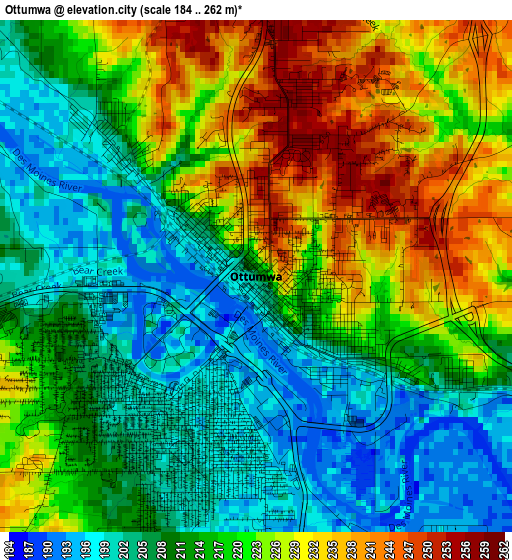
Below is the Elevation map of Ottumwa, which displays elevation range with different colors. Scale of the first map is from 184 to 262 m (604 to 860 ft) with average elevation of 216.2 meters (=709 ft) [note 1]
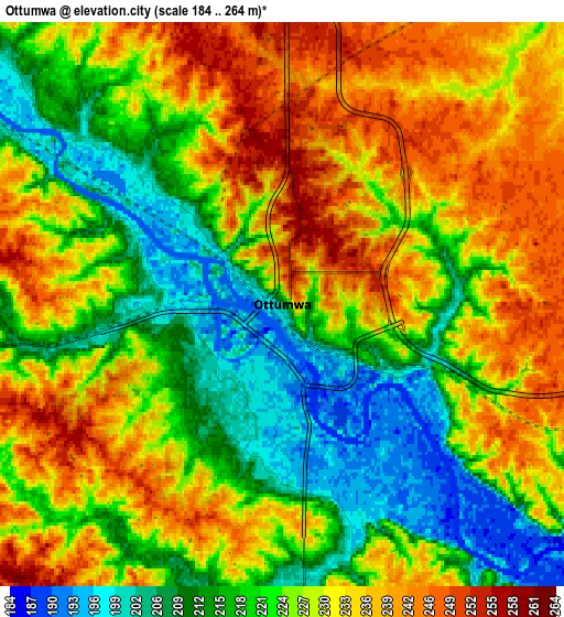
These maps also provides idea of topography and contour of this city, they are displayed at different zoom levels. More info about maps, scale and edge coordinates you can find below images.
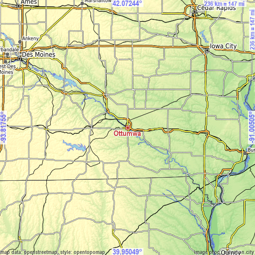
| \ | Map #1 | Map #2 | Topo.Map |
| Scale [m] | 184..262 m | 184..264 m | × |
| Scale [ft] | 604..860 ft | 604..866 ft | × |
| Average | 216.2 m = 709 ft | 225.9 m = 741 ft | × |
| Width | 7.37 km = 4.6 mi | 14.75 km = 9.2 mi | 235.9 km = 146.6 mi |
| Height | 7.37 km = 4.6 mi | 14.75 km = 9.2 mi | 235.9 km = 146.6 mi |
| ↑Max Latitude | 41.053158° | 41.086288° | 42.07244° |
| Latitude at center | 41.02001° | 41.02001° | 41.02001° |
| ↓Min Latitude | 40.986846° | 40.953665° | 39.95049° |
| ← Min Longitude | -92.455245° | -92.499191° | -93.81755° |
| Longitude center | -92.4113° | -92.4113° | -92.4113° |
| →Max Longitude | -92.367355° | -92.323409° | -91.00505° |
Nearby cities:
Cities around Ottumwa sort by population:
• Oskaloosa elevation 256 m
36.4 km,  327°
327°
• Pella 273 m
60.4 km,  315°
315°
• Fairfield 237 m
37.7 km,  91°
91°
• Centerville 311 m
50.2 km,  230°
230°
• Albia 292 m
33.1 km,  271°
271°
• Bloomfield 265 m
29.8 km,  180°
180°
• Sigourney 243 m
38.9 km,  26°
26°
• Maharishi Vedic City 240 m
35.1 km,  84°
84°
• New Sharon 269 m
53.9 km,  338°
338°
• Eddyville 204 m
24.3 km,  308°
308°
• Keosauqua 179 m
49.6 km,  130°
130°
• Lancaster 291 m
56.4 km,  190°
190°
Multilingual:
 En español:
Ottumwa elevación 205 m.
 En France:
Ottumwa élévation 205 m.


Sources and notes:
- [note 1] Map square and city borders are not equal. Map elevation data is calculated only from area inside that square.
- [src 1] Elevation data from geonames database provided with same terms of usage.
- [src 2] The elevation map of Ottumwa is generated using elevation data from NASA's 3 arcsec (90m) resolution SRTM data.
- [src 3] Base (background) map © OpenStreetMap contributors tiles are generated by Geofabrik and OpenTopoMap.
Copyright & License:
This Ottumwa Elevation Map is licensed under CC BY-SA. You may reuse any part from this page, if you give a proper credit by linking to this URL:
 More info on terms of use page.