Mallory elevation
Mallory (West Virginia, Logan County), United States elevation is 244 meters and Mallory elevation in feet is 801 ft above sea level [src 1]. Mallory is a populated place (feature code) with elevation that is 35 meters (115 ft) smaller than average city elevation in United States.
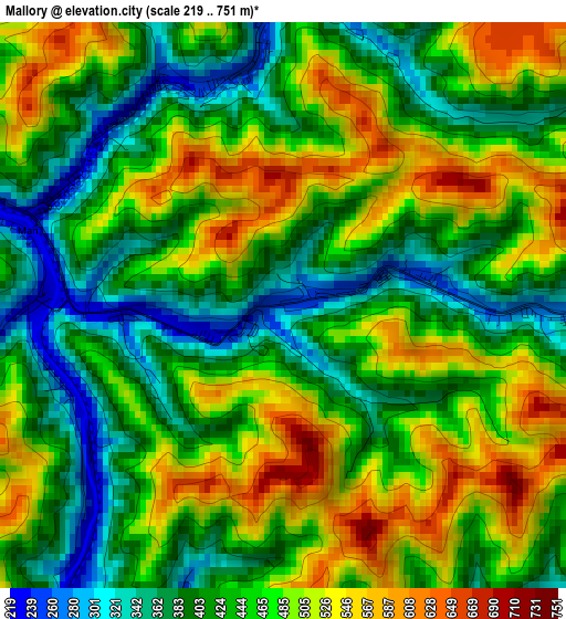
Below is the Elevation map of Mallory, which displays elevation range with different colors. Scale of the first map is from 219 to 751 m (719 to 2464 ft) with average elevation of 453 meters (=1486 ft) [note 1]
These maps also provides idea of topography and contour of this city, they are displayed at different zoom levels. More info about maps, scale and edge coordinates you can find below images.
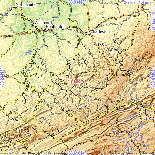
| \ | Map #1 | Topo.Map |
| Scale [m] | 219..751 m | × |
| Scale [ft] | 719..2464 ft | × |
| Average | 453 m = 1486 ft | × |
| Width | 7.73 km = 4.8 mi | 247.3 km = 153.7 mi |
| Height | 7.73 km = 4.8 mi | 247.3 km = 153.7 mi |
| ↑Max Latitude | 37.765408° | 38.83448° |
| Latitude at center | 37.73066° | 37.73066° |
| ↓Min Latitude | 37.695896° | 36.61014° |
| ← Min Longitude | -81.881845° | -83.24415° |
| Longitude center | -81.8379° | -81.8379° |
| →Max Longitude | -81.793955° | -80.43165° |
Nearby cities:
Cities around Mallory sort by population:
• Williamson elevation 200 m
39.2 km,  260°
260°
• Madison 221 m
37.4 km,  2°
2°
• Crab Orchard 695 m
53.4 km,  88°
88°
• Welch 405 m
39.9 km,  146°
146°
• Mount Gay-Shamrock 327 m
20.7 km,  305°
305°
• Logan 204 m
19 km, 313°
• Mullens 436 m
43.5 km,  112°
112°
• Sophia 706 m
51.7 km, 92°
• Oceana 380 m
19.3 km,  102°
102°
• Chapmanville 197 m
31.3 km,  329°
329°
• Gilbert Creek 346 m
17.9 km,  196°
196°
• Pineville 396 m
31.1 km,  121°
121°
Multilingual:
 En español:
Mallory elevación 244 m.
 En France:
Mallory élévation 244 m.


Sources and notes:
- [note 1] Map square and city borders are not equal. Map elevation data is calculated only from area inside that square.
- [src 1] Elevation data from geonames database provided with same terms of usage.
- [src 2] The elevation map of Mallory is generated using elevation data from NASA's 3 arcsec (90m) resolution SRTM data.
- [src 3] Base (background) map © OpenStreetMap contributors tiles are generated by Geofabrik and OpenTopoMap.
Copyright & License:
This Mallory Elevation Map is licensed under CC BY-SA. You may reuse any part from this page, if you give a proper credit by linking to this URL:
 More info on terms of use page.