Taylor elevation
Taylor (Texas, Williamson County), United States elevation is 176 meters and Taylor elevation in feet is 577 ft above sea level [src 1]. Taylor is a populated place (feature code) with elevation that is 103 meters (338 ft) smaller than average city elevation in United States.
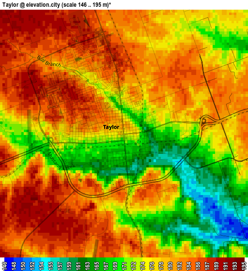
Below is the Elevation map of Taylor, which displays elevation range with different colors. Scale of the first map is from 146 to 195 m (479 to 640 ft) with average elevation of 177.7 meters (=583 ft) [note 1]
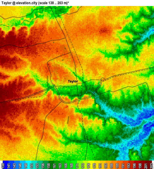
These maps also provides idea of topography and contour of this city, they are displayed at different zoom levels. More info about maps, scale and edge coordinates you can find below images.
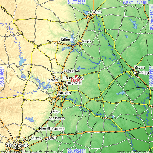
| \ | Map #1 | Map #2 | Topo.Map |
| Scale [m] | 146..195 m | 138..203 m | × |
| Scale [ft] | 479..640 ft | 453..666 ft | × |
| Average | 177.7 m = 583 ft | 176.3 m = 578 ft | × |
| Width | 8.41 km = 5.2 mi | 16.83 km = 10.5 mi | 269.2 km = 167.3 mi |
| Height | 8.41 km = 5.2 mi | 16.83 km = 10.5 mi | 269.2 km = 167.3 mi |
| ↑Max Latitude | 30.60859° | 30.646404° | 31.77393° |
| Latitude at center | 30.57076° | 30.57076° | 30.57076° |
| ↓Min Latitude | 30.532916° | 30.495057° | 29.35248° |
| ← Min Longitude | -97.453385° | -97.497331° | -98.81569° |
| Longitude center | -97.40944° | -97.40944° | -97.40944° |
| →Max Longitude | -97.365495° | -97.321549° | -96.00319° |
Nearby cities:
Cities around Taylor sort by population:
• Round Rock elevation 226 m
26.7 km,  254°
254°
• Georgetown 235 m
26.5 km,  285°
285°
• Pflugerville 224 m
24.9 km,  234°
234°
• Hutto 203 m
13.5 km,  256°
256°
• Wells Branch 256 m
29.3 km,  241°
241°
• Elgin 180 m
24.9 km,  171°
171°
• Manor 165 m
29.2 km,  208°
208°
• Bartlett 185 m
25 km,  356°
356°
• Serenada 254 m
30.6 km,  297°
297°
• Granger 179 m
16.6 km,  348°
348°
• Thorndale 141 m
20.1 km,  76°
76°
• Windemere 234 m
26.1 km, 241°
Multilingual:
 En español:
Taylor elevación 176 m.
 En France:
Taylor élévation 176 m.


Sources and notes:
- [note 1] Map square and city borders are not equal. Map elevation data is calculated only from area inside that square.
- [src 1] Elevation data from geonames database provided with same terms of usage.
- [src 2] The elevation map of Taylor is generated using elevation data from NASA's 3 arcsec (90m) resolution SRTM data.
- [src 3] Base (background) map © OpenStreetMap contributors tiles are generated by Geofabrik and OpenTopoMap.
Copyright & License:
This Taylor Elevation Map is licensed under CC BY-SA. You may reuse any part from this page, if you give a proper credit by linking to this URL:
 More info on terms of use page.