Bartlett elevation
Bartlett (Texas, Williamson County), United States elevation is 185 meters and Bartlett elevation in feet is 607 ft above sea level [src 1]. Bartlett is a populated place (feature code) with elevation that is 94 meters (308 ft) smaller than average city elevation in United States.
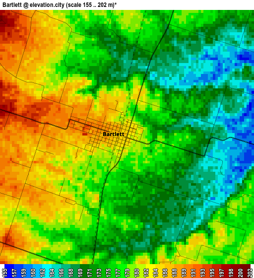
Below is the Elevation map of Bartlett, which displays elevation range with different colors. Scale of the first map is from 155 to 202 m (509 to 663 ft) with average elevation of 177 meters (=581 ft) [note 1]
These maps also provides idea of topography and contour of this city, they are displayed at different zoom levels. More info about maps, scale and edge coordinates you can find below images.
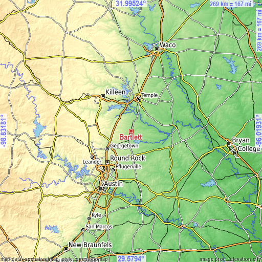
| \ | Map #1 | Topo.Map |
| Scale [m] | 155..202 m | × |
| Scale [ft] | 509..663 ft | × |
| Average | 177 m = 581 ft | × |
| Width | 8.39 km = 5.2 mi | 268.6 km = 166.9 mi |
| Height | 8.39 km = 5.2 mi | 268.6 km = 166.9 mi |
| ↑Max Latitude | 30.832652° | 31.99524° |
| Latitude at center | 30.79491° | 30.79491° |
| ↓Min Latitude | 30.757153° | 29.5794° |
| ← Min Longitude | -97.469505° | -98.83181° |
| Longitude center | -97.42556° | -97.42556° |
| →Max Longitude | -97.381615° | -96.01931° |
Nearby cities:
Cities around Bartlett sort by population:
• Georgetown elevation 235 m
30.1 km,  233°
233°
• Belton 165 m
29.3 km,  352°
352°
• Taylor 176 m
25 km,  176°
176°
• Sparks 147 m
16.1 km,  22°
22°
• Salado 193 m
20.1 km,  327°
327°
• Little River-Academy 149 m
22.2 km, 16°
• Serenada 254 m
27.6 km,  247°
247°
• Granger 179 m
8.7 km,  190°
190°
• Thorndale 141 m
29.1 km,  133°
133°
• Rogers 169 m
24.3 km,  51°
51°
• Jarrell 267 m
17.4 km,  281°
281°
• Holland 163 m
9.5 km,  13°
13°
Multilingual:
 En español:
Bartlett elevación 185 m.
 En France:
Bartlett élévation 185 m.
 Auf Deutsch:
Bartlett höhe über dem Meeresspiegel ist 185 m.

Sources and notes:
- [note 1] Map square and city borders are not equal. Map elevation data is calculated only from area inside that square.
- [src 1] Elevation data from geonames database provided with same terms of usage.
- [src 2] The elevation map of Bartlett is generated using elevation data from NASA's 3 arcsec (90m) resolution SRTM data.
- [src 3] Base (background) map © OpenStreetMap contributors tiles are generated by Geofabrik and OpenTopoMap.
Copyright & License:
This Bartlett Elevation Map is licensed under CC BY-SA. You may reuse any part from this page, if you give a proper credit by linking to this URL:
 More info on terms of use page.