Leonard elevation
Leonard (Texas, Fannin County), United States elevation is 221 meters and Leonard elevation in feet is 725 ft above sea level [src 1]. Leonard is a populated place (feature code) with elevation that is 58 meters (190 ft) smaller than average city elevation in United States.
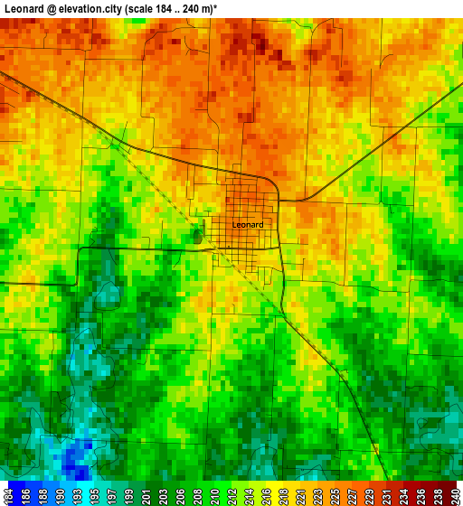
Below is the Elevation map of Leonard, which displays elevation range with different colors. Scale of the first map is from 184 to 240 m (604 to 787 ft) with average elevation of 214.1 meters (=702 ft) [note 1]
These maps also provides idea of topography and contour of this city, they are displayed at different zoom levels. More info about maps, scale and edge coordinates you can find below images.
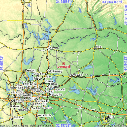
| \ | Map #1 | Topo.Map |
| Scale [m] | 184..240 m | × |
| Scale [ft] | 604..787 ft | × |
| Average | 214.1 m = 702 ft | × |
| Width | 8.16 km = 5.1 mi | 261.1 km = 162.2 mi |
| Height | 8.16 km = 5.1 mi | 261.1 km = 162.2 mi |
| ↑Max Latitude | 33.416239° | 34.54586° |
| Latitude at center | 33.37955° | 33.37955° |
| ↓Min Latitude | 33.342846° | 32.19739° |
| ← Min Longitude | -96.291425° | -97.65373° |
| Longitude center | -96.24748° | -96.24748° |
| →Max Longitude | -96.203535° | -94.84123° |
Nearby cities:
Cities around Leonard sort by population:
• Greenville elevation 169 m
29.7 km,  154°
154°
• Anna 221 m
28.2 km,  263°
263°
• Bonham 189 m
22.9 km,  16°
16°
• Princeton 178 m
32.2 km,  226°
226°
• Melissa 211 m
32 km,  250°
250°
• Farmersville 203 m
26.2 km,  203°
203°
• Van Alstyne 240 m
31 km,  278°
278°
• Whitewright 235 m
20 km,  317°
317°
• Caddo Mills 168 m
34.9 km,  176°
176°
• Bells 217 m
29.8 km,  329°
329°
• Wolfe City 215 m
16.6 km,  93°
93°
• Tom Bean 253 m
26.9 km,  305°
305°
Multilingual:
 En español:
Leonard elevación 221 m.
 En France:
Leonard élévation 221 m.


Sources and notes:
- [note 1] Map square and city borders are not equal. Map elevation data is calculated only from area inside that square.
- [src 1] Elevation data from geonames database provided with same terms of usage.
- [src 2] The elevation map of Leonard is generated using elevation data from NASA's 3 arcsec (90m) resolution SRTM data.
- [src 3] Base (background) map © OpenStreetMap contributors tiles are generated by Geofabrik and OpenTopoMap.
Copyright & License:
This Leonard Elevation Map is licensed under CC BY-SA. You may reuse any part from this page, if you give a proper credit by linking to this URL:
 More info on terms of use page.