Anna elevation
Anna (Texas, Collin County), United States elevation is 221 meters and Anna elevation in feet is 725 ft above sea level [src 1]. Anna is a populated place (feature code) with elevation that is 58 meters (190 ft) smaller than average city elevation in United States.
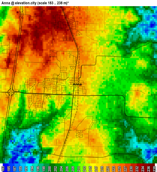
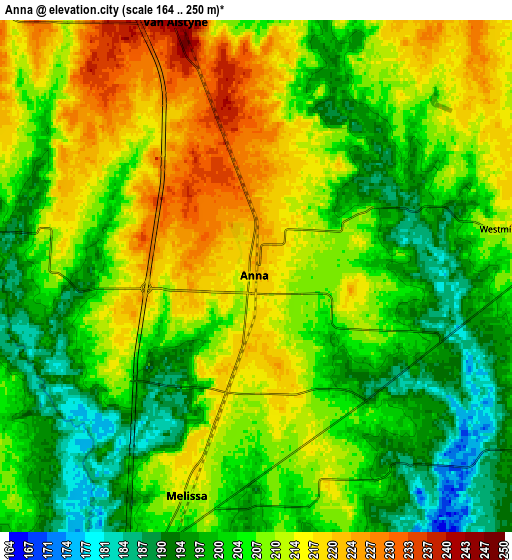
Below is the Elevation map of Anna, which displays elevation range with different colors. Scale of the first map is from 183 to 238 m (600 to 781 ft) with average elevation of 213.4 meters (=700 ft) [note 1]
These maps also provides idea of topography and contour of this city, they are displayed at different zoom levels. More info about maps, scale and edge coordinates you can find below images.
| \ | Map #1 | Map #2 | Topo.Map |
| Scale [m] | 183..238 m | 164..250 m | × |
| Scale [ft] | 600..781 ft | 538..820 ft | × |
| Average | 213.4 m = 700 ft | 206.8 m = 678 ft | × |
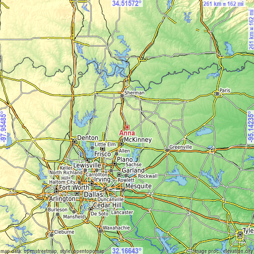
| Width | 8.16 km = 5.1 mi | 16.33 km = 10.1 mi | 261.2 km = 162.3 mi |
| Height | 8.16 km = 5.1 mi | 16.33 km = 10.1 mi | 261.2 km = 162.3 mi |
| ↑Max Latitude | 33.385701° | 33.422387° | 34.51572° |
| Latitude at center | 33.349° | 33.349° | 33.349° |
| ↓Min Latitude | 33.312283° | 33.275551° | 32.16643° |
| ← Min Longitude | -96.592545° | -96.636491° | -97.95485° |
| Longitude center | -96.5486° | -96.5486° | -96.5486° |
| →Max Longitude | -96.504655° | -96.460709° | -95.14235° |
Nearby cities:
Cities around Anna sort by population:
• McKinney elevation 197 m
17.9 km,  200°
200°
• Prosper 215 m
26.6 km,  241°
241°
• Princeton 178 m
19.4 km,  165°
165°
• Fairview 197 m
22.6 km, 199°
• Celina 217 m
22.1 km,  262°
262°
• Melissa 211 m
7.4 km, 197°
• Van Alstyne 240 m
8.5 km,  341°
341°
• Howe 260 m
18.7 km, 341°
• Lowry Crossing 160 m
21.6 km,  179°
179°
• Whitewright 235 m
23.3 km,  38°
38°
• Gunter 217 m
21.5 km,  300°
300°
• Tom Bean 253 m
20 km,  17°
17°
Multilingual:
 En español:
Anna elevación 221 m.
 En France:
Anna élévation 221 m.


Sources and notes:
- [note 1] Map square and city borders are not equal. Map elevation data is calculated only from area inside that square.
- [src 1] Elevation data from geonames database provided with same terms of usage.
- [src 2] The elevation map of Anna is generated using elevation data from NASA's 3 arcsec (90m) resolution SRTM data.
- [src 3] Base (background) map © OpenStreetMap contributors tiles are generated by Geofabrik and OpenTopoMap.
Copyright & License:
This Anna Elevation Map is licensed under CC BY-SA. You may reuse any part from this page, if you give a proper credit by linking to this URL:
 More info on terms of use page.