Princeton elevation
Princeton (Texas, Collin County), United States elevation is 178 meters and Princeton elevation in feet is 584 ft above sea level [src 1]. Princeton is a populated place (feature code) with elevation that is 101 meters (331 ft) smaller than average city elevation in United States.
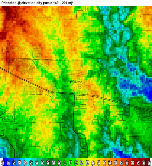
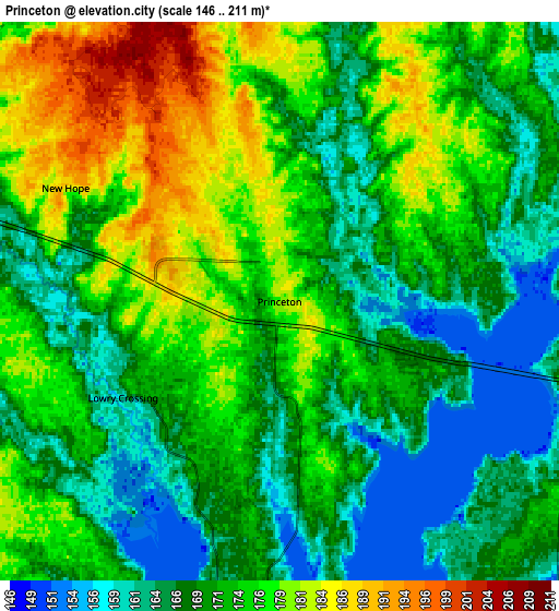
Below is the Elevation map of Princeton, which displays elevation range with different colors. Scale of the first map is from 149 to 201 m (489 to 659 ft) with average elevation of 174 meters (=571 ft) [note 1]
These maps also provides idea of topography and contour of this city, they are displayed at different zoom levels. More info about maps, scale and edge coordinates you can find below images.
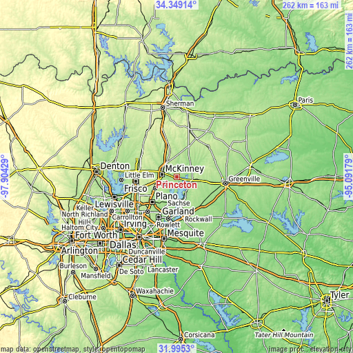
| \ | Map #1 | Map #2 | Topo.Map |
| Scale [m] | 149..201 m | 146..211 m | × |
| Scale [ft] | 489..659 ft | 479..692 ft | × |
| Average | 174 m = 571 ft | 171.3 m = 562 ft | × |
| Width | 8.18 km = 5.1 mi | 16.36 km = 10.2 mi | 261.7 km = 162.6 mi |
| Height | 8.18 km = 5.1 mi | 16.36 km = 10.2 mi | 261.7 km = 162.6 mi |
| ↑Max Latitude | 33.216892° | 33.25365° | 34.34914° |
| Latitude at center | 33.18012° | 33.18012° | 33.18012° |
| ↓Min Latitude | 33.143332° | 33.106529° | 31.9953° |
| ← Min Longitude | -96.541985° | -96.585931° | -97.90429° |
| Longitude center | -96.49804° | -96.49804° | -96.49804° |
| →Max Longitude | -96.454095° | -96.410149° | -95.09179° |
Nearby cities:
Cities around Princeton sort by population:
• McKinney elevation 197 m
11.1 km,  280°
280°
• Allen 205 m
18.2 km,  241°
241°
• Wylie 174 m
18.7 km,  191°
191°
• Fairview 197 m
12.7 km,  258°
258°
• Melissa 211 m
13.7 km,  329°
329°
• Lucas 179 m
12.9 km,  214°
214°
• Parker 187 m
18 km,  219°
219°
• Farmersville 203 m
13 km,  98°
98°
• Lavon 163 m
18 km,  160°
160°
• Lowry Crossing 160 m
5.4 km, 238°
• Saint Paul 176 m
16.2 km,  197°
197°
• Nevada 200 m
19.2 km,  142°
142°
Multilingual:
 En español:
Princeton elevación 178 m.
 En France:
Princeton élévation 178 m.
 Auf Deutsch:
Princeton höhe über dem Meeresspiegel ist 178 m.

Sources and notes:
- [note 1] Map square and city borders are not equal. Map elevation data is calculated only from area inside that square.
- [src 1] Elevation data from geonames database provided with same terms of usage.
- [src 2] The elevation map of Princeton is generated using elevation data from NASA's 3 arcsec (90m) resolution SRTM data.
- [src 3] Base (background) map © OpenStreetMap contributors tiles are generated by Geofabrik and OpenTopoMap.
Copyright & License:
This Princeton Elevation Map is licensed under CC BY-SA. You may reuse any part from this page, if you give a proper credit by linking to this URL:
 More info on terms of use page.