Allen elevation
Allen (Texas, Collin County), United States elevation is 205 meters and Allen elevation in feet is 673 ft above sea level [src 1]. Allen is a populated place (feature code) with elevation that is 74 meters (243 ft) smaller than average city elevation in United States.
Below is the Elevation map of Allen, which displays elevation range with different colors. Scale of the first map is from 172 to 224 m (564 to 735 ft) with average elevation of 200.7 meters (=658 ft) [note 1]
These maps also provides idea of topography and contour of this city, they are displayed at different zoom levels. More info about maps, scale and edge coordinates you can find below images.
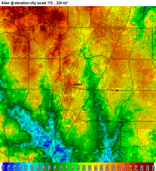
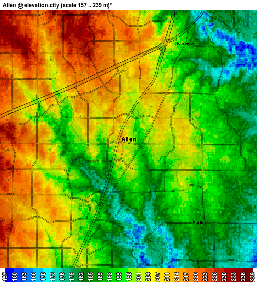
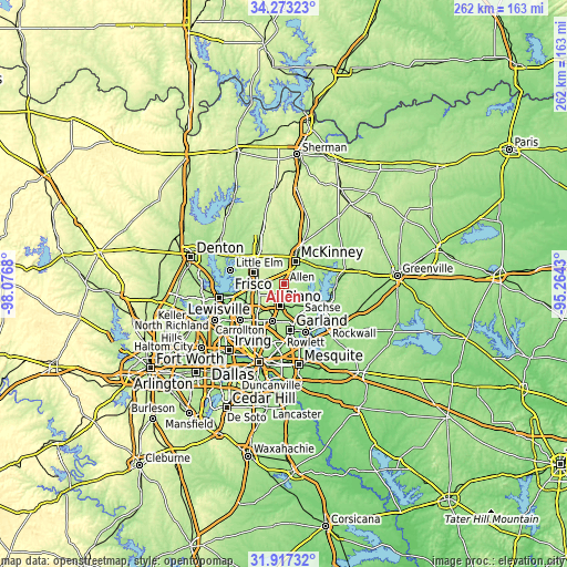
| \ | Map #1 | Map #2 | Topo.Map |
| Scale [m] | 172..224 m | 157..239 m | × |
| Scale [ft] | 564..735 ft | 515..784 ft | × |
| Average | 200.7 m = 658 ft | 199.7 m = 655 ft | × |
| Width | 8.19 km = 5.1 mi | 16.37 km = 10.2 mi | 262 km = 162.8 mi |
| Height | 8.19 km = 5.1 mi | 16.37 km = 10.2 mi | 262 km = 162.8 mi |
| ↑Max Latitude | 33.139975° | 33.176764° | 34.27323° |
| Latitude at center | 33.10317° | 33.10317° | 33.10317° |
| ↓Min Latitude | 33.06635° | 33.029514° | 31.91732° |
| ← Min Longitude | -96.714495° | -96.758441° | -98.0768° |
| Longitude center | -96.67055° | -96.67055° | -96.67055° |
| →Max Longitude | -96.626605° | -96.582659° | -95.2643° |
Nearby cities:
Cities around Allen sort by population:
• Plano elevation 207 m
9.6 km,  195°
195°
• McKinney 197 m
11.7 km,  26°
26°
• Frisco 216 m
15.2 km,  290°
290°
• Richardson 195 m
18.1 km, 197°
• Wylie 174 m
15.7 km,  128°
128°
• Sachse 169 m
15.8 km,  153°
153°
• Murphy 177 m
11.2 km, 151°
• Fairview 197 m
7.1 km, 30°
• Lucas 179 m
9 km,  103°
103°
• Parker 187 m
7 km,  139°
139°
• Lowry Crossing 160 m
12.8 km,  63°
63°
• Saint Paul 176 m
13.2 km,  121°
121°
Multilingual:
 En español:
Allen elevación 205 m.
 En France:
Allen élévation 205 m.


Sources and notes:
- [note 1] Map square and city borders are not equal. Map elevation data is calculated only from area inside that square.
- [src 1] Elevation data from geonames database provided with same terms of usage.
- [src 2] The elevation map of Allen is generated using elevation data from NASA's 3 arcsec (90m) resolution SRTM data.
- [src 3] Base (background) map © OpenStreetMap contributors tiles are generated by Geofabrik and OpenTopoMap.
Copyright & License:
This Allen Elevation Map is licensed under CC BY-SA. You may reuse any part from this page, if you give a proper credit by linking to this URL:
 More info on terms of use page.