Edgewood elevation
Edgewood (Texas, Van Zandt County), United States elevation is 144 meters and Edgewood elevation in feet is 472 ft above sea level [src 1]. Edgewood is a populated place (feature code) with elevation that is 135 meters (443 ft) smaller than average city elevation in United States.
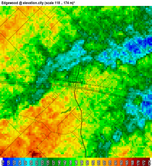
Below is the Elevation map of Edgewood, which displays elevation range with different colors. Scale of the first map is from 118 to 174 m (387 to 571 ft) with average elevation of 144.2 meters (=473 ft) [note 1]
These maps also provides idea of topography and contour of this city, they are displayed at different zoom levels. More info about maps, scale and edge coordinates you can find below images.
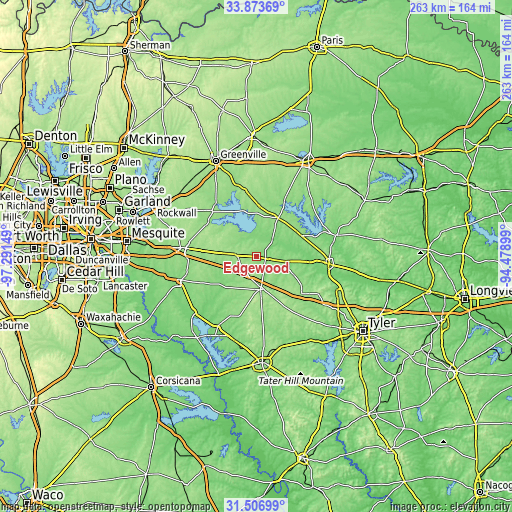
| \ | Map #1 | Topo.Map |
| Scale [m] | 118..174 m | × |
| Scale [ft] | 387..571 ft | × |
| Average | 144.2 m = 473 ft | × |
| Width | 8.22 km = 5.1 mi | 263.2 km = 163.5 mi |
| Height | 8.22 km = 5.1 mi | 263.2 km = 163.5 mi |
| ↑Max Latitude | 32.735154° | 33.87369° |
| Latitude at center | 32.69818° | 32.69818° |
| ↓Min Latitude | 32.661191° | 31.50699° |
| ← Min Longitude | -95.929185° | -97.29149° |
| Longitude center | -95.88524° | -95.88524° |
| →Max Longitude | -95.841295° | -94.47899° |
Nearby cities:
Cities around Edgewood sort by population:
• Terrell elevation 158 m
36.7 km,  276°
276°
• Kaufman 145 m
41.5 km,  252°
252°
• Mineola 131 m
37.4 km,  95°
95°
• Canton 158 m
15.9 km,  172°
172°
• Wills Point 167 m
11.6 km, 276°
• Grand Saline 126 m
16.7 km, 99°
• Van 155 m
30.2 km,  129°
129°
• Quitman 128 m
42 km,  75°
75°
• Gunter 129 m
30.5 km,  51°
51°
• West Tawakoni 147 m
25.6 km,  328°
328°
• Quinlan 161 m
33.2 km,  315°
315°
• Emory 145 m
22.6 km,  29°
29°
Multilingual:
 En español:
Edgewood elevación 144 m.
 En France:
Edgewood élévation 144 m.
 Auf Deutsch:
Edgewood höhe über dem Meeresspiegel ist 144 m.

Sources and notes:
- [note 1] Map square and city borders are not equal. Map elevation data is calculated only from area inside that square.
- [src 1] Elevation data from geonames database provided with same terms of usage.
- [src 2] The elevation map of Edgewood is generated using elevation data from NASA's 3 arcsec (90m) resolution SRTM data.
- [src 3] Base (background) map © OpenStreetMap contributors tiles are generated by Geofabrik and OpenTopoMap.
Copyright & License:
This Edgewood Elevation Map is licensed under CC BY-SA. You may reuse any part from this page, if you give a proper credit by linking to this URL:
 More info on terms of use page.