Murfreesboro elevation
Murfreesboro (Tennessee, Rutherford County), United States elevation is 191 meters and Murfreesboro elevation in feet is 627 ft above sea level [src 1]. Murfreesboro is a seat of a second-order administrative division (feature code) with elevation that is 88 meters (289 ft) smaller than average city elevation in United States.
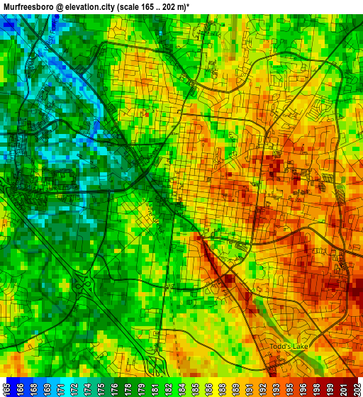
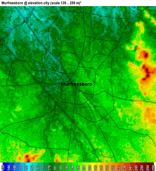
Below is the Elevation map of Murfreesboro, which displays elevation range with different colors. Scale of the first map is from 165 to 202 m (541 to 663 ft) with average elevation of 184.4 meters (=605 ft) [note 1]
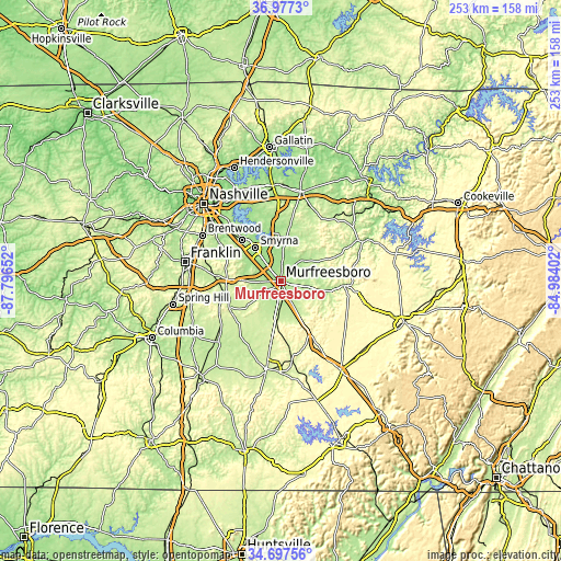
These maps also provides idea of topography and contour of this city, they are displayed at different zoom levels. More info about maps, scale and edge coordinates you can find below images.
| \ | Map #1 | Map #2 | Topo.Map |
| Scale [m] | 165..202 m | 139..259 m | × |
| Scale [ft] | 541..663 ft | 456..850 ft | × |
| Average | 184.4 m = 605 ft | 187.7 m = 616 ft | × |
| Width | 7.92 km = 4.9 mi | 15.84 km = 9.8 mi | 253.5 km = 157.5 mi |
| Height | 7.92 km = 4.9 mi | 15.84 km = 9.8 mi | 253.5 km = 157.5 mi |
| ↑Max Latitude | 35.881234° | 35.916832° | 36.9773° |
| Latitude at center | 35.84562° | 35.84562° | 35.84562° |
| ↓Min Latitude | 35.80999° | 35.774344° | 34.69756° |
| ← Min Longitude | -86.434215° | -86.478161° | -87.79652° |
| Longitude center | -86.39027° | -86.39027° | -86.39027° |
| →Max Longitude | -86.346325° | -86.302379° | -84.98402° |
Nearby cities:
Cities around Murfreesboro sort by population:
• Smyrna elevation 167 m
19.1 km,  322°
322°
• Brentwood 231 m
41 km,  300°
300°
• La Vergne 179 m
25.6 km, 317°
• Brentwood Estates 227 m
40.3 km, 299°
• Shelbyville 237 m
40.8 km,  188°
188°
• Christiana 215 m
15.1 km,  183°
183°
• Nolensville 189 m
27.8 km, 295°
• Woodbury 222 m
28.8 km,  93°
93°
• Rural Hill 176 m
31.2 km,  345°
345°
• Watertown 198 m
36.6 km,  39°
39°
• Chapel Hill 211 m
36.6 km,  228°
228°
• Unionville 221 m
30.9 km,  216°
216°
Multilingual:
 En español:
Murfreesboro elevación 191 m.
 En France:
Murfreesboro élévation 191 m.
 Auf Deutsch:
Murfreesboro höhe über dem Meeresspiegel ist 191 m.
 На русском:
Мерфрисборо, Мурфрисборо высота над уровнем моря 191 м
Sources and notes:
- [note 1] Map square and city borders are not equal. Map elevation data is calculated only from area inside that square.
- [src 1] Elevation data from geonames database provided with same terms of usage.
- [src 2] The elevation map of Murfreesboro is generated using elevation data from NASA's 3 arcsec (90m) resolution SRTM data.
- [src 3] Base (background) map © OpenStreetMap contributors tiles are generated by Geofabrik and OpenTopoMap.
Copyright & License:
This Murfreesboro Elevation Map is licensed under CC BY-SA. You may reuse any part from this page, if you give a proper credit by linking to this URL:
 More info on terms of use page.