Rural Hill elevation
Rural Hill (Tennessee, Wilson County), United States elevation is 176 meters and Rural Hill elevation in feet is 577 ft above sea level [src 1]. Rural Hill is a populated place (feature code) with elevation that is 103 meters (338 ft) smaller than average city elevation in United States.
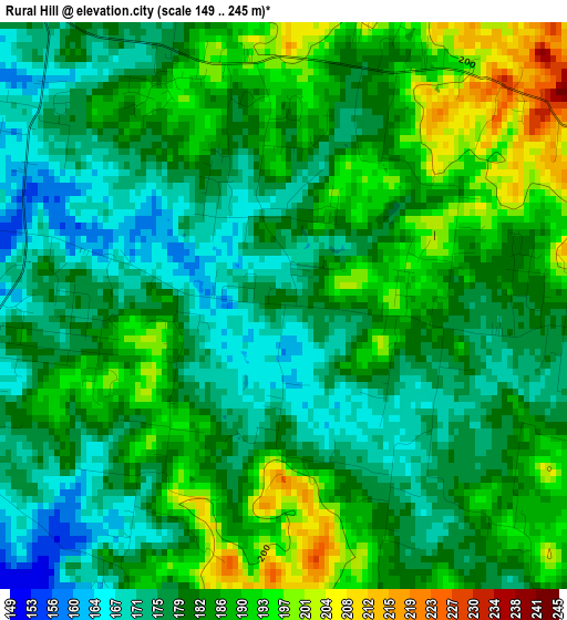
Below is the Elevation map of Rural Hill, which displays elevation range with different colors. Scale of the first map is from 149 to 245 m (489 to 804 ft) with average elevation of 181.9 meters (=597 ft) [note 1]
These maps also provides idea of topography and contour of this city, they are displayed at different zoom levels. More info about maps, scale and edge coordinates you can find below images.
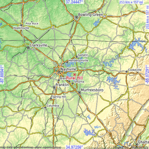
| \ | Map #1 | Topo.Map |
| Scale [m] | 149..245 m | × |
| Scale [ft] | 489..804 ft | × |
| Average | 181.9 m = 597 ft | × |
| Width | 7.89 km = 4.9 mi | 252.6 km = 157 mi |
| Height | 7.89 km = 4.9 mi | 252.6 km = 157 mi |
| ↑Max Latitude | 36.152222° | 37.24447° |
| Latitude at center | 36.11673° | 36.11673° |
| ↓Min Latitude | 36.081222° | 34.97256° |
| ← Min Longitude | -86.523105° | -87.88541° |
| Longitude center | -86.47916° | -86.47916° |
| →Max Longitude | -86.435215° | -85.07291° |
Nearby cities:
Cities around Rural Hill sort by population:
• Nashville elevation 171 m
28 km,  281°
281°
• Hendersonville 148 m
24.4 km,  328°
328°
• Smyrna 167 m
15.3 km,  193°
193°
• Brentwood 231 m
28.8 km,  251°
251°
• La Vergne 179 m
14.6 km,  219°
219°
• Mount Juliet 168 m
9.9 km,  339°
339°
• Brentwood Estates 227 m
28.8 km, 249°
• Lebanon 161 m
19.7 km,  58°
58°
• Nolensville 189 m
25 km, 223°
• Green Hill 197 m
13.4 km, 331°
• Oak Hill 185 m
27.5 km,  263°
263°
• Lakewood 143 m
19.9 km,  315°
315°
Multilingual:
 En español:
Rural Hill elevación 176 m.
 En France:
Rural Hill élévation 176 m.
 Auf Deutsch:
Rural Hill höhe über dem Meeresspiegel ist 176 m.

Sources and notes:
- [note 1] Map square and city borders are not equal. Map elevation data is calculated only from area inside that square.
- [src 1] Elevation data from geonames database provided with same terms of usage.
- [src 2] The elevation map of Rural Hill is generated using elevation data from NASA's 3 arcsec (90m) resolution SRTM data.
- [src 3] Base (background) map © OpenStreetMap contributors tiles are generated by Geofabrik and OpenTopoMap.
Copyright & License:
This Rural Hill Elevation Map is licensed under CC BY-SA. You may reuse any part from this page, if you give a proper credit by linking to this URL:
 More info on terms of use page.