Crossville elevation
Crossville (Tennessee, Cumberland County), United States elevation is 565 meters and Crossville elevation in feet is 1854 ft above sea level [src 1]. Crossville is a seat of a second-order administrative division (feature code) with elevation that is 286 meters (938 ft) bigger than average city elevation in United States.
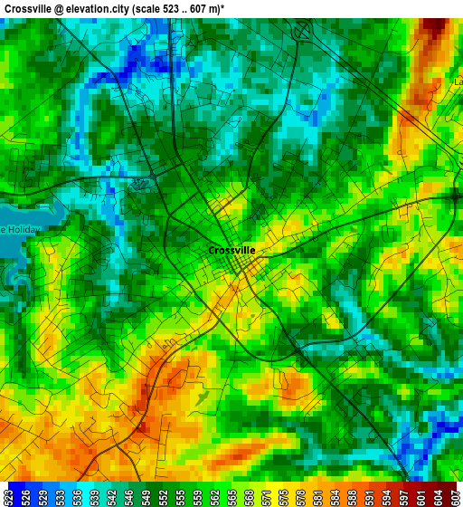
Below is the Elevation map of Crossville, which displays elevation range with different colors. Scale of the first map is from 523 to 607 m (1716 to 1991 ft) with average elevation of 557.7 meters (=1830 ft) [note 1]
These maps also provides idea of topography and contour of this city, they are displayed at different zoom levels. More info about maps, scale and edge coordinates you can find below images.
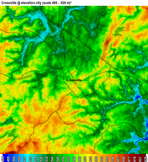
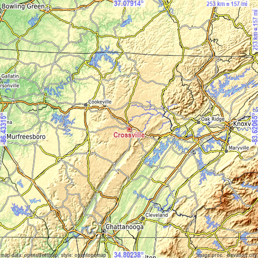
| \ | Map #1 | Map #2 | Topo.Map |
| Scale [m] | 523..607 m | 494..626 m | × |
| Scale [ft] | 1716..1991 ft | 1621..2054 ft | × |
| Average | 557.7 m = 1830 ft | 556.9 m = 1827 ft | × |
| Width | 7.91 km = 4.9 mi | 15.82 km = 9.8 mi | 253.2 km = 157.3 mi |
| Height | 7.91 km = 4.9 mi | 15.82 km = 9.8 mi | 253.2 km = 157.3 mi |
| ↑Max Latitude | 35.984527° | 36.020079° | 37.07914° |
| Latitude at center | 35.94896° | 35.94896° | 35.94896° |
| ↓Min Latitude | 35.913376° | 35.877777° | 34.80238° |
| ← Min Longitude | -85.070845° | -85.114791° | -86.43315° |
| Longitude center | -85.0269° | -85.0269° | -85.0269° |
| →Max Longitude | -84.982955° | -84.939009° | -83.62065° |
Nearby cities:
Cities around Crossville sort by population:
• Fairfield Glade elevation 636 m
13.9 km,  65°
65°
• Harriman 245 m
42.7 km,  92°
92°
• Rockwood 272 m
32.2 km,  106°
106°
• Sparta 279 m
39.4 km,  266°
266°
• Lake Tansi 587 m
8.8 km,  196°
196°
• Monterey 574 m
31 km,  315°
315°
• Spring City 231 m
32.3 km,  152°
152°
• Pikeville 261 m
40.9 km, 200°
• Spencer 548 m
45.5 km,  240°
240°
• Midtown 251 m
42.4 km,  100°
100°
• Grimsley 531 m
35.6 km,  6°
6°
• Wartburg 422 m
42.4 km, 65°
Multilingual:
 En español:
Crossville elevación 565 m.
 En France:
Crossville élévation 565 m.
 Auf Deutsch:
Crossville höhe über dem Meeresspiegel ist 565 m.

Sources and notes:
- [note 1] Map square and city borders are not equal. Map elevation data is calculated only from area inside that square.
- [src 1] Elevation data from geonames database provided with same terms of usage.
- [src 2] The elevation map of Crossville is generated using elevation data from NASA's 3 arcsec (90m) resolution SRTM data.
- [src 3] Base (background) map © OpenStreetMap contributors tiles are generated by Geofabrik and OpenTopoMap.
Copyright & License:
This Crossville Elevation Map is licensed under CC BY-SA. You may reuse any part from this page, if you give a proper credit by linking to this URL:
 More info on terms of use page.