Pikeville elevation
Pikeville (Tennessee, Bledsoe County), United States elevation is 261 meters and Pikeville elevation in feet is 856 ft above sea level [src 1]. Pikeville is a seat of a second-order administrative division (feature code) with elevation that is 18 meters (59 ft) smaller than average city elevation in United States.
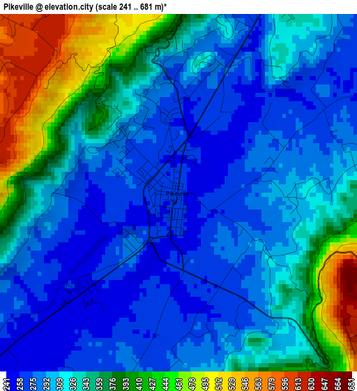
Below is the Elevation map of Pikeville, which displays elevation range with different colors. Scale of the first map is from 241 to 681 m (791 to 2234 ft) with average elevation of 327.1 meters (=1073 ft) [note 1]
These maps also provides idea of topography and contour of this city, they are displayed at different zoom levels. More info about maps, scale and edge coordinates you can find below images.
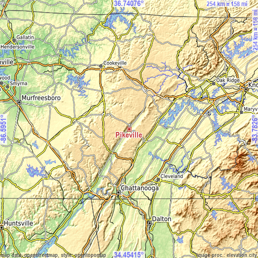
| \ | Map #1 | Topo.Map |
| Scale [m] | 241..681 m | × |
| Scale [ft] | 791..2234 ft | × |
| Average | 327.1 m = 1073 ft | × |
| Width | 7.95 km = 4.9 mi | 254.2 km = 158 mi |
| Height | 7.95 km = 4.9 mi | 254.2 km = 158 mi |
| ↑Max Latitude | 35.641341° | 36.74076° |
| Latitude at center | 35.60562° | 35.60562° |
| ↓Min Latitude | 35.569883° | 34.45415° |
| ← Min Longitude | -85.232795° | -86.5951° |
| Longitude center | -85.18885° | -85.18885° |
| →Max Longitude | -85.144905° | -83.7826° |
Nearby cities:
Cities around Pikeville sort by population:
• Soddy-Daisy elevation 211 m
41.1 km,  180°
180°
• Crossville 565 m
40.9 km,  20°
20°
• Dayton 214 m
20.2 km,  127°
127°
• Dunlap 217 m
31.8 km,  215°
215°
• Sparta 279 m
43.4 km,  325°
325°
• Lake Tansi 587 m
32.1 km, 22°
• Sale Creek 224 m
25.9 km,  163°
163°
• Spring City 231 m
31.2 km,  72°
72°
• Spencer 548 m
29.6 km,  302°
302°
• Mowbray Mountain 504 m
36.8 km, 184°
• Decatur 238 m
37.4 km,  105°
105°
• Graysville 228 m
20 km,  151°
151°
Multilingual:
 En español:
Pikeville elevación 261 m.
 En France:
Pikeville élévation 261 m.
 Auf Deutsch:
Pikeville höhe über dem Meeresspiegel ist 261 m.

Sources and notes:
- [note 1] Map square and city borders are not equal. Map elevation data is calculated only from area inside that square.
- [src 1] Elevation data from geonames database provided with same terms of usage.
- [src 2] The elevation map of Pikeville is generated using elevation data from NASA's 3 arcsec (90m) resolution SRTM data.
- [src 3] Base (background) map © OpenStreetMap contributors tiles are generated by Geofabrik and OpenTopoMap.
Copyright & License:
This Pikeville Elevation Map is licensed under CC BY-SA. You may reuse any part from this page, if you give a proper credit by linking to this URL:
 More info on terms of use page.