Pageland elevation
Pageland (South Carolina, Chesterfield County), United States elevation is 197 meters and Pageland elevation in feet is 646 ft above sea level [src 1]. Pageland is a populated place (feature code) with elevation that is 82 meters (269 ft) smaller than average city elevation in United States.
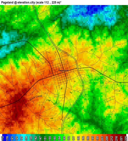
Below is the Elevation map of Pageland, which displays elevation range with different colors. Scale of the first map is from 112 to 225 m (367 to 738 ft) with average elevation of 172.9 meters (=567 ft) [note 1]
These maps also provides idea of topography and contour of this city, they are displayed at different zoom levels. More info about maps, scale and edge coordinates you can find below images.
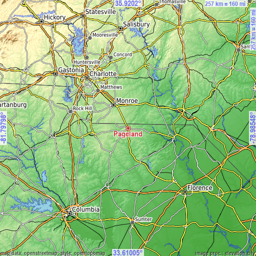
| \ | Map #1 | Topo.Map |
| Scale [m] | 112..225 m | × |
| Scale [ft] | 367..738 ft | × |
| Average | 172.9 m = 567 ft | × |
| Width | 8.03 km = 5 mi | 256.9 km = 159.6 mi |
| Height | 8.03 km = 5 mi | 256.9 km = 159.6 mi |
| ↑Max Latitude | 34.809299° | 35.9202° |
| Latitude at center | 34.77321° | 34.77321° |
| ↓Min Latitude | 34.737105° | 33.61005° |
| ← Min Longitude | -80.435675° | -81.79798° |
| Longitude center | -80.39173° | -80.39173° |
| →Max Longitude | -80.347785° | -78.98548° |
Nearby cities:
Cities around Pageland sort by population:
• Monroe elevation 179 m
27.6 km,  328°
328°
• Waxhaw 203 m
36.2 km,  297°
297°
• Lancaster 165 m
35.1 km,  260°
260°
• Unionville 179 m
36.5 km,  342°
342°
• Wadesboro 155 m
36 km,  52°
52°
• Wingate 172 m
24.1 km,  347°
347°
• Polkton 94 m
31.3 km,  33°
33°
• Mineral Springs 193 m
31.2 km,  305°
305°
• Marshville 169 m
24 km,  5°
5°
• Elgin 183 m
31.9 km,  249°
249°
• Kershaw 159 m
30.2 km,  215°
215°
• Chesterfield 90 m
28 km,  98°
98°
Multilingual:
 En español:
Pageland elevación 197 m.
 En France:
Pageland élévation 197 m.
 Auf Deutsch:
Pageland höhe über dem Meeresspiegel ist 197 m.

Sources and notes:
- [note 1] Map square and city borders are not equal. Map elevation data is calculated only from area inside that square.
- [src 1] Elevation data from geonames database provided with same terms of usage.
- [src 2] The elevation map of Pageland is generated using elevation data from NASA's 3 arcsec (90m) resolution SRTM data.
- [src 3] Base (background) map © OpenStreetMap contributors tiles are generated by Geofabrik and OpenTopoMap.
Copyright & License:
This Pageland Elevation Map is licensed under CC BY-SA. You may reuse any part from this page, if you give a proper credit by linking to this URL:
 More info on terms of use page.