Wadesboro elevation
Wadesboro (North Carolina, Anson County), United States elevation is 155 meters and Wadesboro elevation in feet is 509 ft above sea level [src 1]. Wadesboro is a seat of a second-order administrative division (feature code) with elevation that is 124 meters (407 ft) smaller than average city elevation in United States.
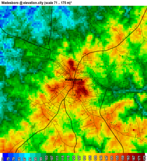
Below is the Elevation map of Wadesboro, which displays elevation range with different colors. Scale of the first map is from 71 to 175 m (233 to 574 ft) with average elevation of 119.9 meters (=393 ft) [note 1]
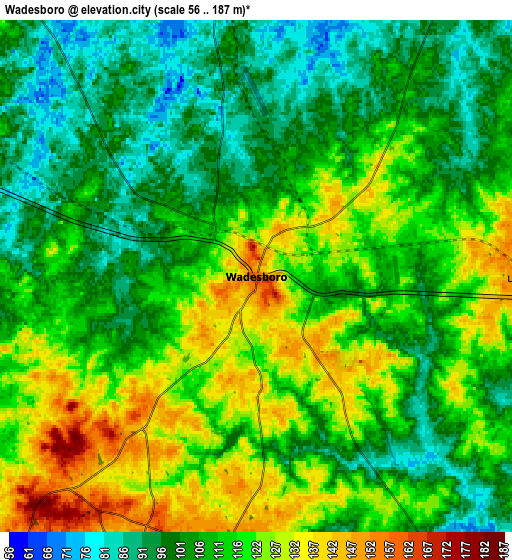
These maps also provides idea of topography and contour of this city, they are displayed at different zoom levels. More info about maps, scale and edge coordinates you can find below images.
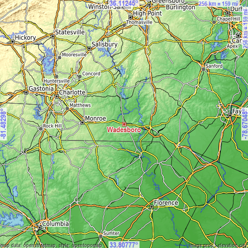
| \ | Map #1 | Map #2 | Topo.Map |
| Scale [m] | 71..175 m | 56..187 m | × |
| Scale [ft] | 233..574 ft | 184..614 ft | × |
| Average | 119.9 m = 393 ft | 111.7 m = 366 ft | × |
| Width | 8.01 km = 5 mi | 16.02 km = 10 mi | 256.3 km = 159.3 mi |
| Height | 8.01 km = 5 mi | 16.02 km = 10 mi | 256.3 km = 159.3 mi |
| ↑Max Latitude | 35.004214° | 35.040202° | 36.11245° |
| Latitude at center | 34.96821° | 34.96821° | 34.96821° |
| ↓Min Latitude | 34.93219° | 34.896155° | 33.80777° |
| ← Min Longitude | -80.120675° | -80.164621° | -81.48298° |
| Longitude center | -80.07673° | -80.07673° | -80.07673° |
| →Max Longitude | -80.032785° | -79.988839° | -78.67048° |
Nearby cities:
Cities around Wadesboro sort by population:
• Rockingham elevation 86 m
27.8 km,  96°
96°
• Cheraw 47 m
34.9 km,  149°
149°
• Wingate 172 m
34 km,  273°
273°
• East Rockingham 76 m
29.2 km, 100°
• Polkton 94 m
12.1 km,  291°
291°
• Marshville 169 m
26.5 km, 274°
• Norwood 121 m
28.2 km,  352°
352°
• Cordova 88 m
24 km, 104°
• Burnsville 164 m
22.1 km,  316°
316°
• Chesterfield 90 m
25.8 km,  182°
182°
• Mount Gilead 123 m
28.3 km,  13°
13°
• Ellerbe 165 m
30.9 km,  68°
68°
Multilingual:
 En español:
Wadesboro elevación 155 m.
 En France:
Wadesboro élévation 155 m.
 Auf Deutsch:
Wadesboro höhe über dem Meeresspiegel ist 155 m.

Sources and notes:
- [note 1] Map square and city borders are not equal. Map elevation data is calculated only from area inside that square.
- [src 1] Elevation data from geonames database provided with same terms of usage.
- [src 2] The elevation map of Wadesboro is generated using elevation data from NASA's 3 arcsec (90m) resolution SRTM data.
- [src 3] Base (background) map © OpenStreetMap contributors tiles are generated by Geofabrik and OpenTopoMap.
Copyright & License:
This Wadesboro Elevation Map is licensed under CC BY-SA. You may reuse any part from this page, if you give a proper credit by linking to this URL:
 More info on terms of use page.