Atglen elevation
Atglen (Pennsylvania, Chester County), United States elevation is 149 meters and Atglen elevation in feet is 489 ft above sea level [src 1]. Atglen is a populated place (feature code) with elevation that is 130 meters (427 ft) smaller than average city elevation in United States.
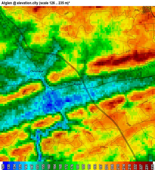
Below is the Elevation map of Atglen, which displays elevation range with different colors. Scale of the first map is from 126 to 235 m (413 to 771 ft) with average elevation of 181.8 meters (=596 ft) [note 1]
These maps also provides idea of topography and contour of this city, they are displayed at different zoom levels. More info about maps, scale and edge coordinates you can find below images.
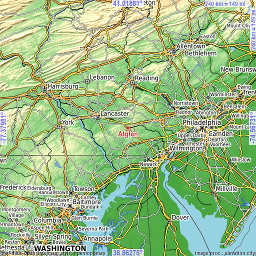
| \ | Map #1 | Topo.Map |
| Scale [m] | 126..235 m | × |
| Scale [ft] | 413..771 ft | × |
| Average | 181.8 m = 596 ft | × |
| Width | 7.49 km = 4.7 mi | 239.7 km = 148.9 mi |
| Height | 7.49 km = 4.7 mi | 239.7 km = 148.9 mi |
| ↑Max Latitude | 39.982951° | 41.01881° |
| Latitude at center | 39.94927° | 39.94927° |
| ↓Min Latitude | 39.915573° | 38.86275° |
| ← Min Longitude | -76.017505° | -77.37981° |
| Longitude center | -75.97356° | -75.97356° |
| →Max Longitude | -75.929615° | -74.56731° |
Nearby cities:
Cities around Atglen sort by population:
• Coatesville elevation 99 m
13.3 km,  73°
73°
• Oxford 172 m
18.2 km,  181°
181°
• Parkesburg 165 m
4.7 km,  77°
77°
• Quarryville 153 m
17.2 km,  250°
250°
• Gap 168 m
5.8 km,  316°
316°
• Honey Brook 228 m
17 km,  18°
18°
• Caln 99 m
17.1 km, 74°
• South Coatesville 109 m
13.4 km, 78°
• Intercourse 134 m
14.9 km,  311°
311°
• Christiana 147 m
2.1 km,  287°
287°
• Paradise 114 m
14.8 km,  297°
297°
• Georgetown 207 m
9.4 km,  262°
262°
Multilingual:
 En español:
Atglen elevación 149 m.
 En France:
Atglen élévation 149 m.


Sources and notes:
- [note 1] Map square and city borders are not equal. Map elevation data is calculated only from area inside that square.
- [src 1] Elevation data from geonames database provided with same terms of usage.
- [src 2] The elevation map of Atglen is generated using elevation data from NASA's 3 arcsec (90m) resolution SRTM data.
- [src 3] Base (background) map © OpenStreetMap contributors tiles are generated by Geofabrik and OpenTopoMap.
Copyright & License:
This Atglen Elevation Map is licensed under CC BY-SA. You may reuse any part from this page, if you give a proper credit by linking to this URL:
 More info on terms of use page.