Oxford elevation
Oxford (Pennsylvania, Chester County), United States elevation is 172 meters and Oxford elevation in feet is 564 ft above sea level [src 1]. Oxford is a populated place (feature code) with elevation that is 107 meters (351 ft) smaller than average city elevation in United States.
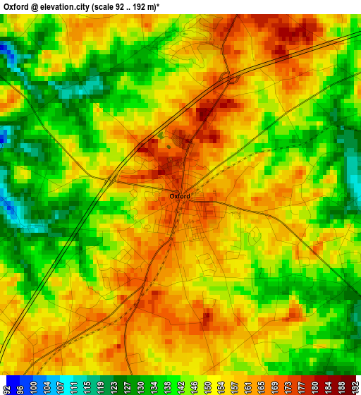
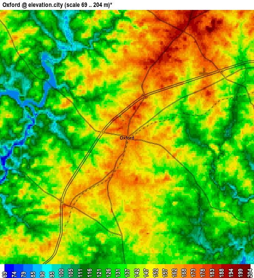
Below is the Elevation map of Oxford, which displays elevation range with different colors. Scale of the first map is from 92 to 192 m (302 to 630 ft) with average elevation of 149.9 meters (=492 ft) [note 1]
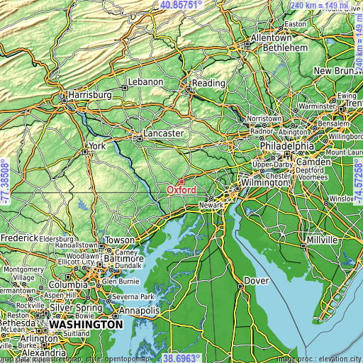
These maps also provides idea of topography and contour of this city, they are displayed at different zoom levels. More info about maps, scale and edge coordinates you can find below images.
| \ | Map #1 | Map #2 | Topo.Map |
| Scale [m] | 92..192 m | 69..204 m | × |
| Scale [ft] | 302..630 ft | 226..669 ft | × |
| Average | 149.9 m = 492 ft | 139.5 m = 458 ft | × |
| Width | 7.51 km = 4.7 mi | 15.02 km = 9.3 mi | 240.3 km = 149.3 mi |
| Height | 7.51 km = 4.7 mi | 15.02 km = 9.3 mi | 240.3 km = 149.3 mi |
| ↑Max Latitude | 39.819151° | 39.852896° | 40.85751° |
| Latitude at center | 39.78539° | 39.78539° | 39.78539° |
| ↓Min Latitude | 39.751612° | 39.717818° | 38.6963° |
| ← Min Longitude | -76.022775° | -76.066721° | -77.38508° |
| Longitude center | -75.97883° | -75.97883° | -75.97883° |
| →Max Longitude | -75.934885° | -75.890939° | -74.57258° |
Nearby cities:
Cities around Oxford sort by population:
• North Star elevation 112 m
22.4 km,  96°
96°
• North East 5 m
20.8 km,  171°
171°
• Parkesburg 165 m
19.9 km,  14°
14°
• Upland 166 m
20.8 km,  57°
57°
• West Grove 122 m
13.6 km,  72°
72°
• Rising Sun 119 m
12.1 km,  216°
216°
• Quarryville 153 m
20.1 km,  308°
308°
• Toughkenamon 105 m
19.6 km, 74°
• Atglen 149 m
18.2 km,  1°
1°
• Avondale 86 m
17.2 km,  75°
75°
• Christiana 147 m
18.9 km,  355°
355°
• Georgetown 207 m
19.1 km,  332°
332°
Multilingual:
 En español:
Oxford elevación 172 m.
 En France:
Oxford élévation 172 m.


Sources and notes:
- [note 1] Map square and city borders are not equal. Map elevation data is calculated only from area inside that square.
- [src 1] Elevation data from geonames database provided with same terms of usage.
- [src 2] The elevation map of Oxford is generated using elevation data from NASA's 3 arcsec (90m) resolution SRTM data.
- [src 3] Base (background) map © OpenStreetMap contributors tiles are generated by Geofabrik and OpenTopoMap.
Copyright & License:
This Oxford Elevation Map is licensed under CC BY-SA. You may reuse any part from this page, if you give a proper credit by linking to this URL:
 More info on terms of use page.