Tonkawa elevation
Tonkawa (Oklahoma, Kay County), United States elevation is 306 meters and Tonkawa elevation in feet is 1004 ft above sea level [src 1]. Tonkawa is a populated place (feature code) with elevation that is 27 meters (89 ft) bigger than average city elevation in United States.
Below is the Elevation map of Tonkawa, which displays elevation range with different colors. Scale of the first map is from 288 to 326 m (945 to 1070 ft) with average elevation of 304 meters (=997 ft) [note 1]
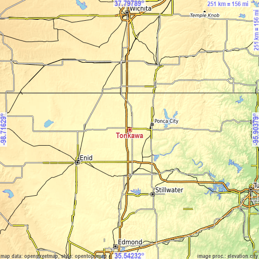
These maps also provides idea of topography and contour of this city, they are displayed at different zoom levels. More info about maps, scale and edge coordinates you can find below images.
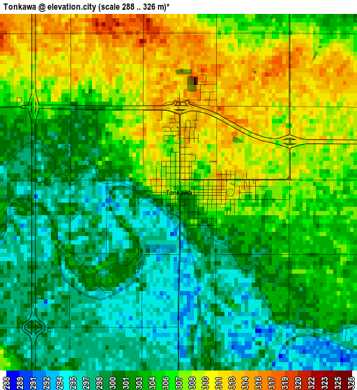
| \ | Map #1 | Topo.Map |
| Scale [m] | 288..326 m | × |
| Scale [ft] | 945..1070 ft | × |
| Average | 304 m = 997 ft | × |
| Width | 7.84 km = 4.9 mi | 250.8 km = 155.8 mi |
| Height | 7.84 km = 4.9 mi | 250.8 km = 155.8 mi |
| ↑Max Latitude | 36.713606° | 37.79789° |
| Latitude at center | 36.67837° | 36.67837° |
| ↓Min Latitude | 36.643118° | 35.54232° |
| ← Min Longitude | -97.353985° | -98.71629° |
| Longitude center | -97.31004° | -97.31004° |
| →Max Longitude | -97.266095° | -95.90379° |
Nearby cities:
Cities around Tonkawa sort by population:
• Enid elevation 388 m
59.7 km,  238°
238°
• Ponca City 315 m
20.3 km,  80°
80°
• Arkansas City 345 m
49 km,  29°
29°
• Wellington 380 m
65.5 km,  355°
355°
• Blackwell 316 m
14.2 km,  9°
9°
• Perry 312 m
43.3 km,  177°
177°
• Newkirk 357 m
32.2 km,  45°
45°
• Pawnee 270 m
59 km,  129°
129°
• McCord 328 m
24.1 km,  89°
89°
• Fairfax 262 m
55.3 km,  102°
102°
• Caldwell 356 m
47.4 km,  326°
326°
• Medford 338 m
40.4 km,  290°
290°
Multilingual:
 En español:
Tonkawa elevación 306 m.
 En France:
Tonkawa élévation 306 m.


Sources and notes:
- [note 1] Map square and city borders are not equal. Map elevation data is calculated only from area inside that square.
- [src 1] Elevation data from geonames database provided with same terms of usage.
- [src 2] The elevation map of Tonkawa is generated using elevation data from NASA's 3 arcsec (90m) resolution SRTM data.
- [src 3] Base (background) map © OpenStreetMap contributors tiles are generated by Geofabrik and OpenTopoMap.
Copyright & License:
This Tonkawa Elevation Map is licensed under CC BY-SA. You may reuse any part from this page, if you give a proper credit by linking to this URL:
 More info on terms of use page.