Salina elevation
Salina (Oklahoma, Mayes County), United States elevation is 197 meters and Salina elevation in feet is 646 ft above sea level [src 1]. Salina is a populated place (feature code) with elevation that is 82 meters (269 ft) smaller than average city elevation in United States.
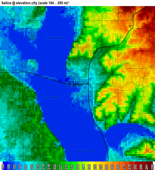
Below is the Elevation map of Salina, which displays elevation range with different colors. Scale of the first map is from 184 to 295 m (604 to 968 ft) with average elevation of 216.5 meters (=710 ft) [note 1]
These maps also provides idea of topography and contour of this city, they are displayed at different zoom levels. More info about maps, scale and edge coordinates you can find below images.
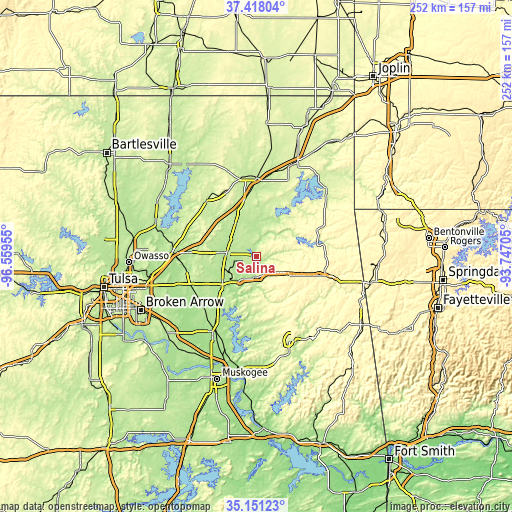
| \ | Map #1 | Topo.Map |
| Scale [m] | 184..295 m | × |
| Scale [ft] | 604..968 ft | × |
| Average | 216.5 m = 710 ft | × |
| Width | 7.88 km = 4.9 mi | 252 km = 156.6 mi |
| Height | 7.88 km = 4.9 mi | 252 km = 156.6 mi |
| ↑Max Latitude | 36.328282° | 37.41804° |
| Latitude at center | 36.29287° | 36.29287° |
| ↓Min Latitude | 36.257442° | 35.15123° |
| ← Min Longitude | -95.197245° | -96.55955° |
| Longitude center | -95.1533° | -95.1533° |
| →Max Longitude | -95.109355° | -93.74705° |
Nearby cities:
Cities around Salina sort by population:
• Pryor Creek elevation 194 m
14.8 km,  276°
276°
• Pryor 195 m
14.8 km, 276°
• Vinita 215 m
38.5 km,  359°
359°
• Jay 318 m
35 km,  65°
65°
• Chouteau 193 m
20.8 km,  235°
235°
• Chelsea 222 m
36.8 km,  317°
317°
• Inola 188 m
35.6 km, 243°
• Cleora 244 m
35.7 km,  27°
27°
• Locust Grove 207 m
10.4 km,  187°
187°
• Justice 208 m
37 km,  270°
270°
• Bushyhead 236 m
35.8 km,  301°
301°
• Kenwood 233 m
15.2 km,  80°
80°
Multilingual:
 En español:
Salina elevación 197 m.
 En France:
Salina élévation 197 m.


Sources and notes:
- [note 1] Map square and city borders are not equal. Map elevation data is calculated only from area inside that square.
- [src 1] Elevation data from geonames database provided with same terms of usage.
- [src 2] The elevation map of Salina is generated using elevation data from NASA's 3 arcsec (90m) resolution SRTM data.
- [src 3] Base (background) map © OpenStreetMap contributors tiles are generated by Geofabrik and OpenTopoMap.
Copyright & License:
This Salina Elevation Map is licensed under CC BY-SA. You may reuse any part from this page, if you give a proper credit by linking to this URL:
 More info on terms of use page.