Pryor Creek elevation
Pryor Creek (Oklahoma, Mayes County), United States elevation is 194 meters and Pryor Creek elevation in feet is 636 ft above sea level [src 1]. Pryor Creek is a populated place (feature code) with elevation that is 85 meters (279 ft) smaller than average city elevation in United States.
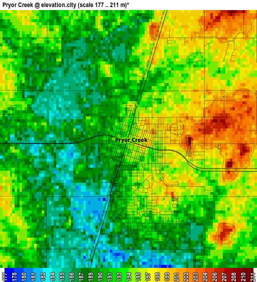
Below is the Elevation map of Pryor Creek, which displays elevation range with different colors. Scale of the first map is from 177 to 211 m (581 to 692 ft) with average elevation of 192.4 meters (=631 ft) [note 1]
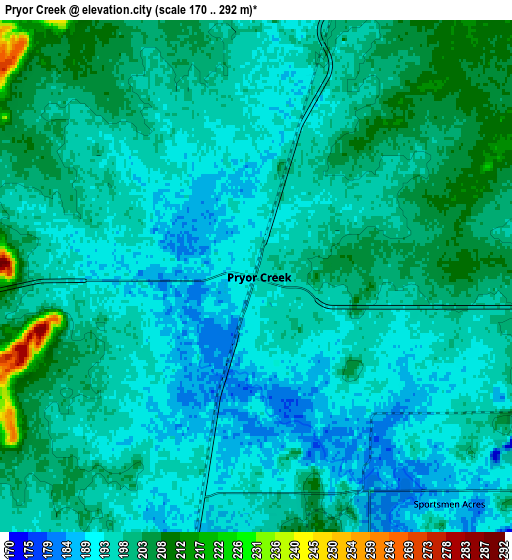
These maps also provides idea of topography and contour of this city, they are displayed at different zoom levels. More info about maps, scale and edge coordinates you can find below images.
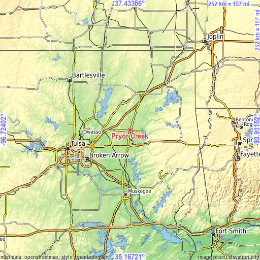
| \ | Map #1 | Map #2 | Topo.Map |
| Scale [m] | 177..211 m | 170..292 m | × |
| Scale [ft] | 581..692 ft | 558..958 ft | × |
| Average | 192.4 m = 631 ft | 197.3 m = 647 ft | × |
| Width | 7.88 km = 4.9 mi | 15.75 km = 9.8 mi | 252 km = 156.6 mi |
| Height | 7.88 km = 4.9 mi | 15.75 km = 9.8 mi | 252 km = 156.6 mi |
| ↑Max Latitude | 36.344025° | 36.379414° | 37.43356° |
| Latitude at center | 36.30862° | 36.30862° | 36.30862° |
| ↓Min Latitude | 36.273199° | 36.237762° | 35.16721° |
| ← Min Longitude | -95.361715° | -95.405661° | -96.72402° |
| Longitude center | -95.31777° | -95.31777° | -95.31777° |
| →Max Longitude | -95.273825° | -95.229879° | -93.91152° |
Nearby cities:
Cities around Pryor Creek sort by population:
• Claremore elevation 187 m
26.7 km,  270°
270°
• Pryor 195 m
0.1 km,  105°
105°
• Verdigris 192 m
34.5 km,  256°
256°
• Chouteau 193 m
13.8 km,  189°
189°
• Chelsea 222 m
27.2 km,  337°
337°
• Inola 188 m
24.5 km,  224°
224°
• Locust Grove 207 m
18.1 km,  131°
131°
• Salina 197 m
14.8 km,  96°
96°
• Justice 208 m
22.4 km, 265°
• Bushyhead 236 m
23.2 km,  317°
317°
• Kenwood 233 m
29.8 km,  88°
88°
• Oologah 202 m
38.2 km,  293°
293°
Multilingual:
 En español:
Pryor Creek elevación 194 m.
 En France:
Pryor Creek élévation 194 m.
 Auf Deutsch:
Pryor Creek höhe über dem Meeresspiegel ist 194 m.

Sources and notes:
- [note 1] Map square and city borders are not equal. Map elevation data is calculated only from area inside that square.
- [src 1] Elevation data from geonames database provided with same terms of usage.
- [src 2] The elevation map of Pryor Creek is generated using elevation data from NASA's 3 arcsec (90m) resolution SRTM data.
- [src 3] Base (background) map © OpenStreetMap contributors tiles are generated by Geofabrik and OpenTopoMap.
Copyright & License:
This Pryor Creek Elevation Map is licensed under CC BY-SA. You may reuse any part from this page, if you give a proper credit by linking to this URL:
 More info on terms of use page.