Lynchburg elevation
Lynchburg (Ohio, Highland County), United States elevation is 306 meters and Lynchburg elevation in feet is 1004 ft above sea level [src 1]. Lynchburg is a populated place (feature code) with elevation that is 27 meters (89 ft) bigger than average city elevation in United States.
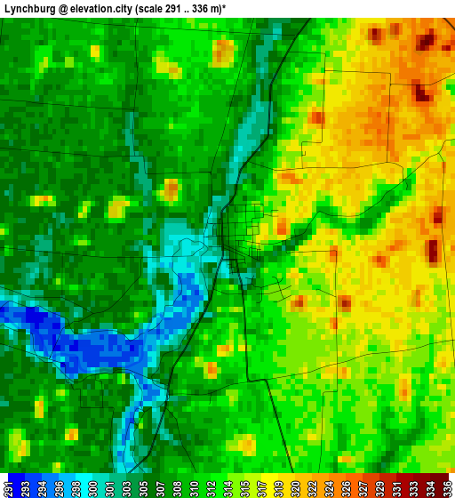
Below is the Elevation map of Lynchburg, which displays elevation range with different colors. Scale of the first map is from 291 to 336 m (955 to 1102 ft) with average elevation of 310.9 meters (=1020 ft) [note 1]
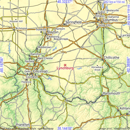
These maps also provides idea of topography and contour of this city, they are displayed at different zoom levels. More info about maps, scale and edge coordinates you can find below images.
| \ | Map #1 | Topo.Map |
| Scale [m] | 291..336 m | × |
| Scale [ft] | 955..1102 ft | × |
| Average | 310.9 m = 1020 ft | × |
| Width | 7.57 km = 4.7 mi | 242.2 km = 150.5 mi |
| Height | 7.57 km = 4.7 mi | 242.2 km = 150.5 mi |
| ↑Max Latitude | 39.275757° | 40.32237° |
| Latitude at center | 39.24173° | 39.24173° |
| ↓Min Latitude | 39.207687° | 38.14418° |
| ← Min Longitude | -83.835255° | -85.19756° |
| Longitude center | -83.79131° | -83.79131° |
| →Max Longitude | -83.747365° | -82.38506° |
Nearby cities:
Cities around Lynchburg sort by population:
• Wilmington elevation 311 m
22.9 km,  351°
351°
• Goshen 254 m
31.9 km,  268°
268°
• Hillsboro 345 m
16.1 km,  105°
105°
• Greenfield 277 m
37.2 km,  70°
70°
• Blanchester 295 m
17.9 km,  288°
288°
• Mount Orab 287 m
26.3 km,  204°
204°
• Williamsburg 249 m
30.7 km,  227°
227°
• Sabina 321 m
30.5 km,  25°
25°
• Leesburg 308 m
23.5 km,  60°
60°
• Morrow 197 m
31.5 km, 293°
• New Vienna 342 m
12.5 km,  43°
43°
• Winchester 296 m
35.5 km,  160°
160°
Multilingual:
 En español:
Lynchburg elevación 306 m.
 En France:
Lynchburg élévation 306 m.
 Auf Deutsch:
Lynchburg höhe über dem Meeresspiegel ist 306 m.

Sources and notes:
- [note 1] Map square and city borders are not equal. Map elevation data is calculated only from area inside that square.
- [src 1] Elevation data from geonames database provided with same terms of usage.
- [src 2] The elevation map of Lynchburg is generated using elevation data from NASA's 3 arcsec (90m) resolution SRTM data.
- [src 3] Base (background) map © OpenStreetMap contributors tiles are generated by Geofabrik and OpenTopoMap.
Copyright & License:
This Lynchburg Elevation Map is licensed under CC BY-SA. You may reuse any part from this page, if you give a proper credit by linking to this URL:
 More info on terms of use page.