Blanchester elevation
Blanchester (Ohio, Clinton County), United States elevation is 295 meters and Blanchester elevation in feet is 968 ft above sea level [src 1]. Blanchester is a populated place (feature code) with elevation that is 16 meters (52 ft) bigger than average city elevation in United States.
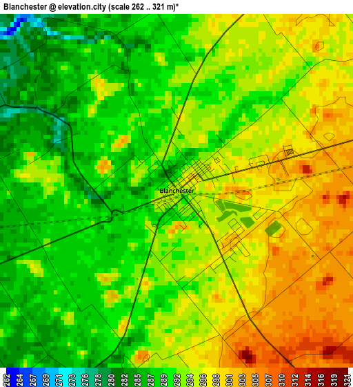
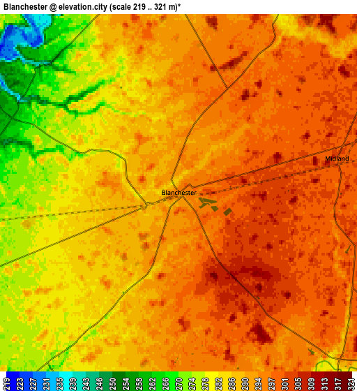
Below is the Elevation map of Blanchester, which displays elevation range with different colors. Scale of the first map is from 262 to 321 m (860 to 1053 ft) with average elevation of 293.1 meters (=962 ft) [note 1]
These maps also provides idea of topography and contour of this city, they are displayed at different zoom levels. More info about maps, scale and edge coordinates you can find below images.
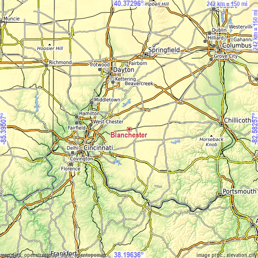
| \ | Map #1 | Map #2 | Topo.Map |
| Scale [m] | 262..321 m | 219..321 m | × |
| Scale [ft] | 860..1053 ft | 719..1053 ft | × |
| Average | 293.1 m = 962 ft | 289.5 m = 950 ft | × |
| Width | 7.56 km = 4.7 mi | 15.13 km = 9.4 mi | 242 km = 150.4 mi |
| Height | 7.56 km = 4.7 mi | 15.13 km = 9.4 mi | 242 km = 150.4 mi |
| ↑Max Latitude | 39.327122° | 39.361107° | 40.37296° |
| Latitude at center | 39.29312° | 39.29312° | 39.29312° |
| ↓Min Latitude | 39.259102° | 39.225067° | 38.19636° |
| ← Min Longitude | -84.032765° | -84.076711° | -85.39507° |
| Longitude center | -83.98882° | -83.98882° | -83.98882° |
| →Max Longitude | -83.944875° | -83.900929° | -82.58257° |
Nearby cities:
Cities around Blanchester sort by population:
• Lebanon elevation 237 m
24.3 km,  310°
310°
• Loveland 184 m
23.8 km,  263°
263°
• Wilmington 311 m
21.8 km,  39°
39°
• Goshen 254 m
16.3 km,  245°
245°
• Mount Repose 263 m
22.7 km,  243°
243°
• South Lebanon 191 m
21.2 km,  294°
294°
• Mulberry 257 m
24.5 km, 243°
• Day Heights 267 m
24.4 km, 237°
• Loveland Park 225 m
23.6 km,  271°
271°
• Lynchburg 306 m
17.9 km,  108°
108°
• Kings Mills 232 m
23.4 km, 287°
• Morrow 197 m
13.7 km,  299°
299°
Multilingual:
 En español:
Blanchester elevación 295 m.
 En France:
Blanchester élévation 295 m.
 Auf Deutsch:
Blanchester höhe über dem Meeresspiegel ist 295 m.

Sources and notes:
- [note 1] Map square and city borders are not equal. Map elevation data is calculated only from area inside that square.
- [src 1] Elevation data from geonames database provided with same terms of usage.
- [src 2] The elevation map of Blanchester is generated using elevation data from NASA's 3 arcsec (90m) resolution SRTM data.
- [src 3] Base (background) map © OpenStreetMap contributors tiles are generated by Geofabrik and OpenTopoMap.
Copyright & License:
This Blanchester Elevation Map is licensed under CC BY-SA. You may reuse any part from this page, if you give a proper credit by linking to this URL:
 More info on terms of use page.