Greenfield elevation
Greenfield (Ohio, Highland County), United States elevation is 277 meters and Greenfield elevation in feet is 909 ft above sea level [src 1]. Greenfield is a populated place (feature code) with elevation that is 2 meters (7 ft) smaller than average city elevation in United States.
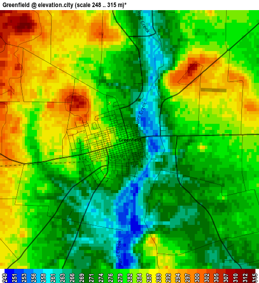
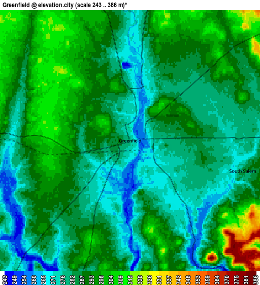
Below is the Elevation map of Greenfield, which displays elevation range with different colors. Scale of the first map is from 248 to 315 m (814 to 1033 ft) with average elevation of 279 meters (=915 ft) [note 1]
These maps also provides idea of topography and contour of this city, they are displayed at different zoom levels. More info about maps, scale and edge coordinates you can find below images.
| \ | Map #1 | Map #2 | Topo.Map |
| Scale [m] | 248..315 m | 243..386 m | × |
| Scale [ft] | 814..1033 ft | 797..1266 ft | × |
| Average | 279 m = 915 ft | 286.9 m = 941 ft | × |
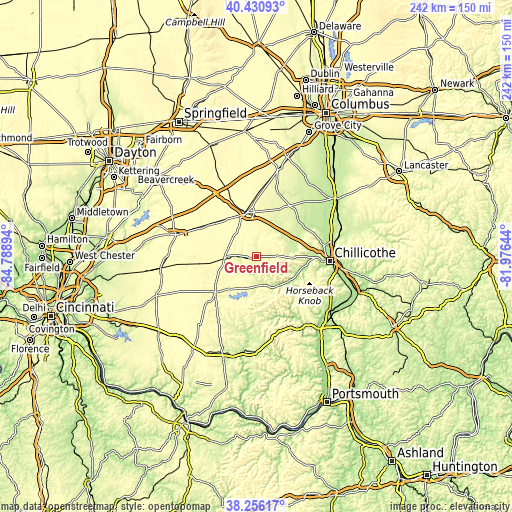
| Width | 7.56 km = 4.7 mi | 15.11 km = 9.4 mi | 241.8 km = 150.2 mi |
| Height | 7.56 km = 4.7 mi | 15.11 km = 9.4 mi | 241.8 km = 150.2 mi |
| ↑Max Latitude | 39.385983° | 39.41994° | 40.43093° |
| Latitude at center | 39.35201° | 39.35201° | 39.35201° |
| ↓Min Latitude | 39.31802° | 39.284014° | 38.25617° |
| ← Min Longitude | -83.426635° | -83.470581° | -84.78894° |
| Longitude center | -83.38269° | -83.38269° | -83.38269° |
| →Max Longitude | -83.338745° | -83.294799° | -81.97644° |
Nearby cities:
Cities around Greenfield sort by population:
• Chillicothe elevation 196 m
34.5 km,  93°
93°
• Washington Court House 300 m
21.1 km,  346°
346°
• Wilmington 311 m
39.7 km,  285°
285°
• Hillsboro 345 m
25.8 km,  229°
229°
• Sabina 321 m
26.6 km,  304°
304°
• North Fork Village 203 m
30.5 km, 93°
• Lynchburg 306 m
37.2 km,  250°
250°
• Leesburg 308 m
14.7 km,  266°
266°
• New Vienna 342 m
26.7 km,  263°
263°
• Jeffersonville 318 m
37 km,  335°
335°
• Frankfort 224 m
18.2 km,  72°
72°
• Williamsport 229 m
34.4 km,  40°
40°
Multilingual:
 En español:
Greenfield elevación 277 m.
 En France:
Greenfield élévation 277 m.
 Auf Deutsch:
Greenfield höhe über dem Meeresspiegel ist 277 m.

Sources and notes:
- [note 1] Map square and city borders are not equal. Map elevation data is calculated only from area inside that square.
- [src 1] Elevation data from geonames database provided with same terms of usage.
- [src 2] The elevation map of Greenfield is generated using elevation data from NASA's 3 arcsec (90m) resolution SRTM data.
- [src 3] Base (background) map © OpenStreetMap contributors tiles are generated by Geofabrik and OpenTopoMap.
Copyright & License:
This Greenfield Elevation Map is licensed under CC BY-SA. You may reuse any part from this page, if you give a proper credit by linking to this URL:
 More info on terms of use page.