Chillicothe elevation
Chillicothe (Ohio, Ross County), United States elevation is 196 meters and Chillicothe elevation in feet is 643 ft above sea level [src 1]. Chillicothe is a seat of a second-order administrative division (feature code) with elevation that is 83 meters (272 ft) smaller than average city elevation in United States.
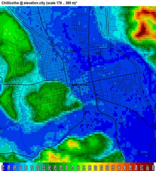
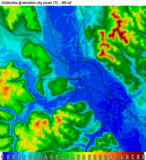
Below is the Elevation map of Chillicothe, which displays elevation range with different colors. Scale of the first map is from 176 to 389 m (577 to 1276 ft) with average elevation of 213 meters (=699 ft) [note 1]
These maps also provides idea of topography and contour of this city, they are displayed at different zoom levels. More info about maps, scale and edge coordinates you can find below images.
| \ | Map #1 | Map #2 | Topo.Map |
| Scale [m] | 176..389 m | 173..395 m | × |
| Scale [ft] | 577..1276 ft | 568..1296 ft | × |
| Average | 213 m = 699 ft | 232.8 m = 764 ft | × |
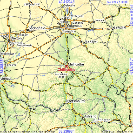
| Width | 7.56 km = 4.7 mi | 15.12 km = 9.4 mi | 241.9 km = 150.3 mi |
| Height | 7.56 km = 4.7 mi | 15.12 km = 9.4 mi | 241.9 km = 150.3 mi |
| ↑Max Latitude | 39.367102° | 39.401068° | 40.41234° |
| Latitude at center | 39.33312° | 39.33312° | 39.33312° |
| ↓Min Latitude | 39.299121° | 39.265106° | 38.23698° |
| ← Min Longitude | -83.026345° | -83.070291° | -84.38865° |
| Longitude center | -82.9824° | -82.9824° | -82.9824° |
| →Max Longitude | -82.938455° | -82.894509° | -81.57615° |
Nearby cities:
Cities around Chillicothe sort by population:
• Circleville elevation 211 m
29.9 km,  5°
5°
• Jackson 214 m
43.2 km,  136°
136°
• Greenfield 277 m
34.5 km,  273°
273°
• Waverly 178 m
22.9 km,  180°
180°
• Ashville 216 m
42.6 km,  3°
3°
• Piketon 175 m
29.6 km,  185°
185°
• North Fork Village 203 m
4 km, 274°
• South Bloomfield 211 m
42.8 km,  359°
359°
• Logan Elm Village 213 m
26.4 km, 5°
• Frankfort 224 m
18.7 km,  294°
294°
• Williamsport 229 m
30.5 km,  337°
337°
• Kingston 239 m
16.8 km,  21°
21°
Multilingual:
 En español:
Chillicothe elevación 196 m.
 En France:
Chillicothe élévation 196 m.
 Auf Deutsch:
Chillicothe höhe über dem Meeresspiegel ist 196 m.

Sources and notes:
- [note 1] Map square and city borders are not equal. Map elevation data is calculated only from area inside that square.
- [src 1] Elevation data from geonames database provided with same terms of usage.
- [src 2] The elevation map of Chillicothe is generated using elevation data from NASA's 3 arcsec (90m) resolution SRTM data.
- [src 3] Base (background) map © OpenStreetMap contributors tiles are generated by Geofabrik and OpenTopoMap.
Copyright & License:
This Chillicothe Elevation Map is licensed under CC BY-SA. You may reuse any part from this page, if you give a proper credit by linking to this URL:
 More info on terms of use page.