Troy elevation
Troy (North Carolina, Montgomery County), United States elevation is 202 meters and Troy elevation in feet is 663 ft above sea level [src 1]. Troy is a seat of a second-order administrative division (feature code) with elevation that is 77 meters (253 ft) smaller than average city elevation in United States.
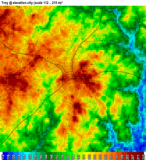
Below is the Elevation map of Troy, which displays elevation range with different colors. Scale of the first map is from 112 to 215 m (367 to 705 ft) with average elevation of 169.4 meters (=556 ft) [note 1]
These maps also provides idea of topography and contour of this city, they are displayed at different zoom levels. More info about maps, scale and edge coordinates you can find below images.
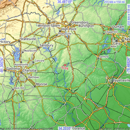
| \ | Map #1 | Topo.Map |
| Scale [m] | 112..215 m | × |
| Scale [ft] | 367..705 ft | × |
| Average | 169.4 m = 556 ft | × |
| Width | 7.97 km = 5 mi | 255 km = 158.4 mi |
| Height | 7.97 km = 5 mi | 255 km = 158.4 mi |
| ↑Max Latitude | 35.394302° | 36.49715° |
| Latitude at center | 35.35847° | 35.35847° |
| ↓Min Latitude | 35.322623° | 34.2035° |
| ← Min Longitude | -79.938435° | -81.30074° |
| Longitude center | -79.89449° | -79.89449° |
| →Max Longitude | -79.850545° | -78.48824° |
Nearby cities:
Cities around Troy sort by population:
• Asheboro elevation 256 m
39.5 km,  10°
10°
• Albemarle 145 m
27.7 km,  268°
268°
• Seven Lakes 176 m
31.2 km,  106°
106°
• Norwood 121 m
25.6 km,  232°
232°
• Badin 159 m
20.8 km,  284°
284°
• Oakboro 160 m
42.1 km,  249°
249°
• Biscoe 187 m
10.4 km,  89°
89°
• Denton 211 m
36.6 km,  326°
326°
• Burnsville 164 m
41.9 km, 229°
• Robbins 132 m
29.1 km,  73°
73°
• Mount Gilead 123 m
18.7 km,  211°
211°
• Ellerbe 165 m
34.1 km,  159°
159°
Multilingual:
 En español:
Troy elevación 202 m.
 En France:
Troy élévation 202 m.


Sources and notes:
- [note 1] Map square and city borders are not equal. Map elevation data is calculated only from area inside that square.
- [src 1] Elevation data from geonames database provided with same terms of usage.
- [src 2] The elevation map of Troy is generated using elevation data from NASA's 3 arcsec (90m) resolution SRTM data.
- [src 3] Base (background) map © OpenStreetMap contributors tiles are generated by Geofabrik and OpenTopoMap.
Copyright & License:
This Troy Elevation Map is licensed under CC BY-SA. You may reuse any part from this page, if you give a proper credit by linking to this URL:
 More info on terms of use page.