Robbins elevation
Robbins (North Carolina, Moore County), United States elevation is 132 meters and Robbins elevation in feet is 433 ft above sea level [src 1]. Robbins is a populated place (feature code) with elevation that is 147 meters (482 ft) smaller than average city elevation in United States.
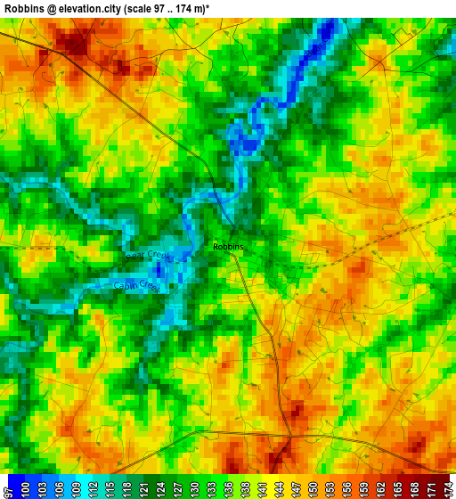
Below is the Elevation map of Robbins, which displays elevation range with different colors. Scale of the first map is from 97 to 174 m (318 to 571 ft) with average elevation of 136.8 meters (=449 ft) [note 1]
These maps also provides idea of topography and contour of this city, they are displayed at different zoom levels. More info about maps, scale and edge coordinates you can find below images.
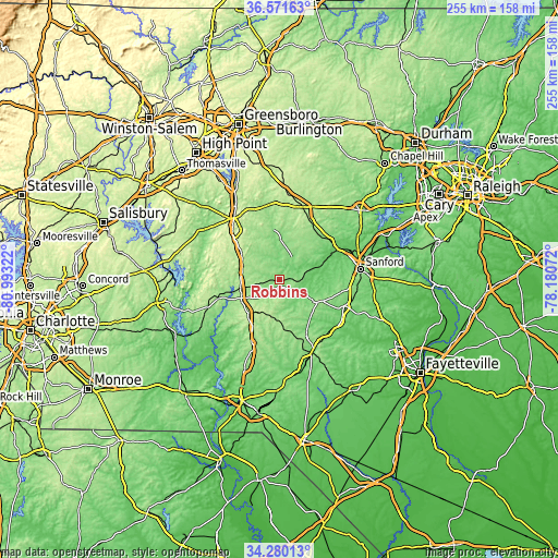
| \ | Map #1 | Topo.Map |
| Scale [m] | 97..174 m | × |
| Scale [ft] | 318..571 ft | × |
| Average | 136.8 m = 449 ft | × |
| Width | 7.96 km = 4.9 mi | 254.8 km = 158.3 mi |
| Height | 7.96 km = 4.9 mi | 254.8 km = 158.3 mi |
| ↑Max Latitude | 35.469828° | 36.57163° |
| Latitude at center | 35.43403° | 35.43403° |
| ↓Min Latitude | 35.398216° | 34.28013° |
| ← Min Longitude | -79.630915° | -80.99322° |
| Longitude center | -79.58697° | -79.58697° |
| →Max Longitude | -79.543025° | -78.18072° |
Nearby cities:
Cities around Robbins sort by population:
• Pinehurst elevation 161 m
28.6 km,  158°
158°
• Southern Pines 155 m
33.9 km,  148°
148°
• Siler City 186 m
34.1 km,  19°
19°
• Aberdeen 101 m
36.5 km, 156°
• Seven Lakes 176 m
17.4 km,  173°
173°
• Farmville 87 m
36.5 km,  65°
65°
• Troy 202 m
29.1 km,  253°
253°
• Whispering Pines 115 m
27.8 km,  135°
135°
• Carthage 178 m
18.3 km,  122°
122°
• Ramseur 148 m
33.8 km,  349°
349°
• Biscoe 187 m
19.3 km,  244°
244°
• Franklinville 138 m
35.7 km,  344°
344°
Multilingual:
 En español:
Robbins elevación 132 m.
 En France:
Robbins élévation 132 m.


Sources and notes:
- [note 1] Map square and city borders are not equal. Map elevation data is calculated only from area inside that square.
- [src 1] Elevation data from geonames database provided with same terms of usage.
- [src 2] The elevation map of Robbins is generated using elevation data from NASA's 3 arcsec (90m) resolution SRTM data.
- [src 3] Base (background) map © OpenStreetMap contributors tiles are generated by Geofabrik and OpenTopoMap.
Copyright & License:
This Robbins Elevation Map is licensed under CC BY-SA. You may reuse any part from this page, if you give a proper credit by linking to this URL:
 More info on terms of use page.