Lynchburg elevation
Lynchburg (Mississippi, Hinds County), United States elevation is 85 meters and Lynchburg elevation in feet is 279 ft above sea level [src 1]. Lynchburg is a populated place (feature code) with elevation that is 194 meters (636 ft) smaller than average city elevation in United States.
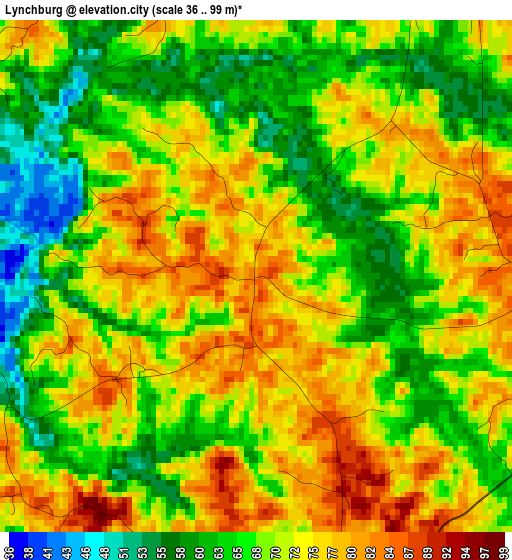
Below is the Elevation map of Lynchburg, which displays elevation range with different colors. Scale of the first map is from 36 to 99 m (118 to 325 ft) with average elevation of 69.9 meters (=229 ft) [note 1]
These maps also provides idea of topography and contour of this city, they are displayed at different zoom levels. More info about maps, scale and edge coordinates you can find below images.
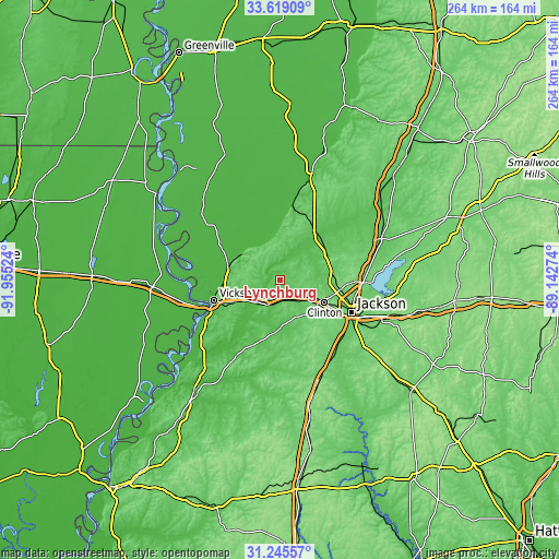
| \ | Map #1 | Topo.Map |
| Scale [m] | 36..99 m | × |
| Scale [ft] | 118..325 ft | × |
| Average | 69.9 m = 229 ft | × |
| Width | 8.25 km = 5.1 mi | 263.9 km = 164 mi |
| Height | 8.25 km = 5.1 mi | 263.9 km = 164 mi |
| ↑Max Latitude | 32.47722° | 33.61909° |
| Latitude at center | 32.44014° | 32.44014° |
| ↓Min Latitude | 32.403045° | 31.24557° |
| ← Min Longitude | -90.592935° | -91.95524° |
| Longitude center | -90.54899° | -90.54899° |
| →Max Longitude | -90.505045° | -89.14274° |
Nearby cities:
Cities around Lynchburg sort by population:
• Jackson elevation 100 m
37.6 km,  114°
114°
• Madison 108 m
40.8 km,  86°
86°
• Clinton 116 m
24 km,  117°
117°
• Ridgeland 113 m
39.1 km, 91°
• Vicksburg 78 m
32.4 km,  252°
252°
• Byram 81 m
40.7 km,  135°
135°
• Flowood 88 m
41.1 km, 110°
• Beechwood 66 m
28.9 km,  244°
244°
• Raymond 104 m
23.3 km,  149°
149°
• Flora 75 m
25.2 km,  62°
62°
• Kearney Park 66 m
27.5 km,  52°
52°
• Edwards 72 m
13.3 km,  203°
203°
Multilingual:
 En español:
Lynchburg elevación 85 m.
 En France:
Lynchburg élévation 85 m.
 Auf Deutsch:
Lynchburg höhe über dem Meeresspiegel ist 85 m.

Sources and notes:
- [note 1] Map square and city borders are not equal. Map elevation data is calculated only from area inside that square.
- [src 1] Elevation data from geonames database provided with same terms of usage.
- [src 2] The elevation map of Lynchburg is generated using elevation data from NASA's 3 arcsec (90m) resolution SRTM data.
- [src 3] Base (background) map © OpenStreetMap contributors tiles are generated by Geofabrik and OpenTopoMap.
Copyright & License:
This Lynchburg Elevation Map is licensed under CC BY-SA. You may reuse any part from this page, if you give a proper credit by linking to this URL:
 More info on terms of use page.