Flowood elevation
Flowood (Mississippi, Rankin County), United States elevation is 88 meters and Flowood elevation in feet is 289 ft above sea level [src 1]. Flowood is a populated place (feature code) with elevation that is 191 meters (627 ft) smaller than average city elevation in United States.
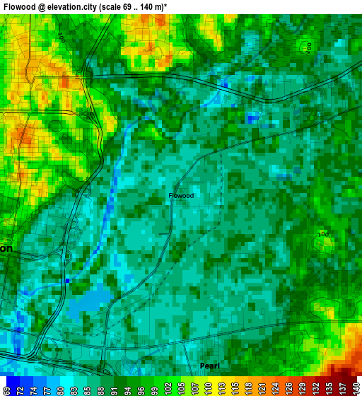
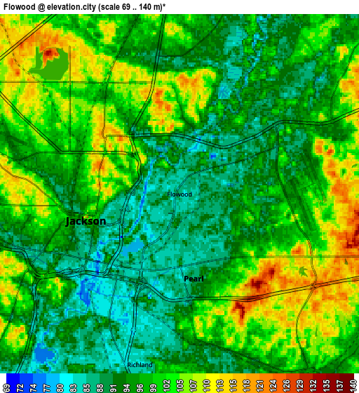
Below is the Elevation map of Flowood, which displays elevation range with different colors. Scale of the first map is from 69 to 140 m (226 to 459 ft) with average elevation of 92.6 meters (=304 ft) [note 1]
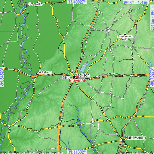
These maps also provides idea of topography and contour of this city, they are displayed at different zoom levels. More info about maps, scale and edge coordinates you can find below images.
| \ | Map #1 | Map #2 | Topo.Map |
| Scale [m] | 69..140 m | 69..140 m | × |
| Scale [ft] | 226..459 ft | 226..459 ft | × |
| Average | 92.6 m = 304 ft | 97.9 m = 321 ft | × |
| Width | 8.26 km = 5.1 mi | 16.52 km = 10.3 mi | 264.3 km = 164.2 mi |
| Height | 8.26 km = 5.1 mi | 16.52 km = 10.3 mi | 264.3 km = 164.2 mi |
| ↑Max Latitude | 32.346724° | 32.383842° | 33.49027° |
| Latitude at center | 32.30959° | 32.30959° | 32.30959° |
| ↓Min Latitude | 32.272441° | 32.235277° | 31.11332° |
| ← Min Longitude | -90.182925° | -90.226871° | -91.54523° |
| Longitude center | -90.13898° | -90.13898° | -90.13898° |
| →Max Longitude | -90.095035° | -90.051089° | -88.73273° |
Nearby cities:
Cities around Flowood sort by population:
• Jackson elevation 100 m
4.5 km,  254°
254°
• Pearl 89 m
3.9 km,  170°
170°
• Madison 108 m
17.1 km,  7°
7°
• Clinton 116 m
17.5 km,  281°
281°
• Ridgeland 113 m
13.2 km,  2°
2°
• Brandon 147 m
14.9 km,  105°
105°
• Byram 81 m
17.6 km,  214°
214°
• Richland 85 m
8.1 km,  193°
193°
• Florence 98 m
17.4 km,  177°
177°
• Raymond 104 m
27.2 km,  258°
258°
• Cleary 122 m
16.5 km, 193°
• Terry 95 m
27.9 km, 211°
Multilingual:
 En español:
Flowood elevación 88 m.
 En France:
Flowood élévation 88 m.


Sources and notes:
- [note 1] Map square and city borders are not equal. Map elevation data is calculated only from area inside that square.
- [src 1] Elevation data from geonames database provided with same terms of usage.
- [src 2] The elevation map of Flowood is generated using elevation data from NASA's 3 arcsec (90m) resolution SRTM data.
- [src 3] Base (background) map © OpenStreetMap contributors tiles are generated by Geofabrik and OpenTopoMap.
Copyright & License:
This Flowood Elevation Map is licensed under CC BY-SA. You may reuse any part from this page, if you give a proper credit by linking to this URL:
 More info on terms of use page.