Grain Valley elevation
Grain Valley (Missouri, Jackson County), United States elevation is 242 meters and Grain Valley elevation in feet is 794 ft above sea level [src 1]. Grain Valley is a populated place (feature code) with elevation that is 37 meters (121 ft) smaller than average city elevation in United States.
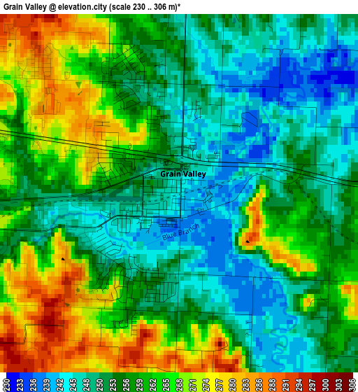
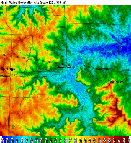
Below is the Elevation map of Grain Valley, which displays elevation range with different colors. Scale of the first map is from 230 to 306 m (755 to 1004 ft) with average elevation of 257.8 meters (=846 ft) [note 1]
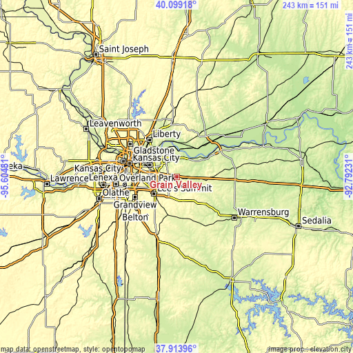
These maps also provides idea of topography and contour of this city, they are displayed at different zoom levels. More info about maps, scale and edge coordinates you can find below images.
| \ | Map #1 | Map #2 | Topo.Map |
| Scale [m] | 230..306 m | 226..318 m | × |
| Scale [ft] | 755..1004 ft | 741..1043 ft | × |
| Average | 257.8 m = 846 ft | 268.2 m = 880 ft | × |
| Width | 7.59 km = 4.7 mi | 15.19 km = 9.4 mi | 243 km = 151 mi |
| Height | 7.59 km = 4.7 mi | 15.19 km = 9.4 mi | 243 km = 151 mi |
| ↑Max Latitude | 39.049146° | 39.083266° | 40.09918° |
| Latitude at center | 39.01501° | 39.01501° | 39.01501° |
| ↓Min Latitude | 38.980857° | 38.946688° | 37.91396° |
| ← Min Longitude | -94.242505° | -94.286451° | -95.60481° |
| Longitude center | -94.19856° | -94.19856° | -94.19856° |
| →Max Longitude | -94.154615° | -94.110669° | -92.79231° |
Nearby cities:
Cities around Grain Valley sort by population:
• Independence elevation 319 m
20.6 km,  294°
294°
• East Independence 262 m
16.2 km,  303°
303°
• Lee's Summit 323 m
19.7 km,  233°
233°
• Blue Springs 300 m
7.2 km,  271°
271°
• Raytown 310 m
22.9 km, 268°
• Oak Grove 271 m
6.1 km,  100°
100°
• Greenwood 295 m
22.1 km,  214°
214°
• Odessa 288 m
21.2 km,  94°
94°
• Sugar Creek 250 m
23.7 km, 296°
• Buckner 231 m
13.1 km,  0°
0°
• Lake Lotawana 281 m
11 km,  201°
201°
• Lone Jack 316 m
16.2 km,  172°
172°
Multilingual:
 En español:
Grain Valley elevación 242 m.
 En France:
Grain Valley élévation 242 m.
 Auf Deutsch:
Grain Valley höhe über dem Meeresspiegel ist 242 m.

Sources and notes:
- [note 1] Map square and city borders are not equal. Map elevation data is calculated only from area inside that square.
- [src 1] Elevation data from geonames database provided with same terms of usage.
- [src 2] The elevation map of Grain Valley is generated using elevation data from NASA's 3 arcsec (90m) resolution SRTM data.
- [src 3] Base (background) map © OpenStreetMap contributors tiles are generated by Geofabrik and OpenTopoMap.
Copyright & License:
This Grain Valley Elevation Map is licensed under CC BY-SA. You may reuse any part from this page, if you give a proper credit by linking to this URL:
 More info on terms of use page.