Chillicothe elevation
Chillicothe (Missouri, Livingston County), United States elevation is 244 meters and Chillicothe elevation in feet is 801 ft above sea level [src 1]. Chillicothe is a seat of a second-order administrative division (feature code) with elevation that is 35 meters (115 ft) smaller than average city elevation in United States.
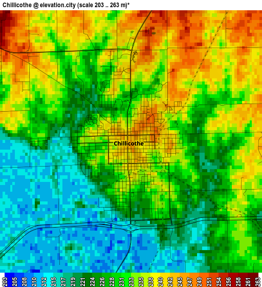
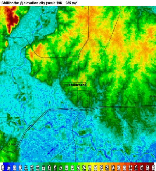
Below is the Elevation map of Chillicothe, which displays elevation range with different colors. Scale of the first map is from 203 to 263 m (666 to 863 ft) with average elevation of 229.7 meters (=754 ft) [note 1]
These maps also provides idea of topography and contour of this city, they are displayed at different zoom levels. More info about maps, scale and edge coordinates you can find below images.
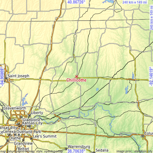
| \ | Map #1 | Map #2 | Topo.Map |
| Scale [m] | 203..263 m | 198..285 m | × |
| Scale [ft] | 666..863 ft | 650..935 ft | × |
| Average | 229.7 m = 754 ft | 227.8 m = 747 ft | × |
| Width | 7.51 km = 4.7 mi | 15.02 km = 9.3 mi | 240.3 km = 149.3 mi |
| Height | 7.51 km = 4.7 mi | 15.02 km = 9.3 mi | 240.3 km = 149.3 mi |
| ↑Max Latitude | 39.829046° | 39.862786° | 40.86726° |
| Latitude at center | 39.79529° | 39.79529° | 39.79529° |
| ↓Min Latitude | 39.761517° | 39.727727° | 38.70635° |
| ← Min Longitude | -93.596385° | -93.640331° | -94.95869° |
| Longitude center | -93.55244° | -93.55244° | -93.55244° |
| →Max Longitude | -93.508495° | -93.464549° | -92.14619° |
Nearby cities:
Cities around Chillicothe sort by population:
• Cameron elevation 317 m
59.2 km,  264°
264°
• Trenton 261 m
32 km,  350°
350°
• Brookfield 232 m
40.9 km,  91°
91°
• Carrollton 232 m
48.8 km,  174°
174°
• Bethany 278 m
66.4 km,  322°
322°
• Marceline 266 m
52.5 km,  100°
100°
• Milan 298 m
58.1 km,  38°
38°
• Gallatin 285 m
37.4 km,  290°
290°
• Hamilton 306 m
38.5 km, 261°
• Keytesville 221 m
66.2 km,  127°
127°
• Kingston 276 m
44.8 km,  247°
247°
• Linneus 257 m
32.4 km,  73°
73°
Multilingual:
 En español:
Chillicothe elevación 244 m.
 En France:
Chillicothe élévation 244 m.
 Auf Deutsch:
Chillicothe höhe über dem Meeresspiegel ist 244 m.

Sources and notes:
- [note 1] Map square and city borders are not equal. Map elevation data is calculated only from area inside that square.
- [src 1] Elevation data from geonames database provided with same terms of usage.
- [src 2] The elevation map of Chillicothe is generated using elevation data from NASA's 3 arcsec (90m) resolution SRTM data.
- [src 3] Base (background) map © OpenStreetMap contributors tiles are generated by Geofabrik and OpenTopoMap.
Copyright & License:
This Chillicothe Elevation Map is licensed under CC BY-SA. You may reuse any part from this page, if you give a proper credit by linking to this URL:
 More info on terms of use page.