Anderson elevation
Anderson (Missouri, McDonald County), United States elevation is 271 meters and Anderson elevation in feet is 889 ft above sea level [src 1]. Anderson is a populated place (feature code) with elevation that is 8 meters (26 ft) smaller than average city elevation in United States.
Below is the Elevation map of Anderson, which displays elevation range with different colors. Scale of the first map is from 259 to 379 m (850 to 1243 ft) with average elevation of 322.3 meters (=1057 ft) [note 1]
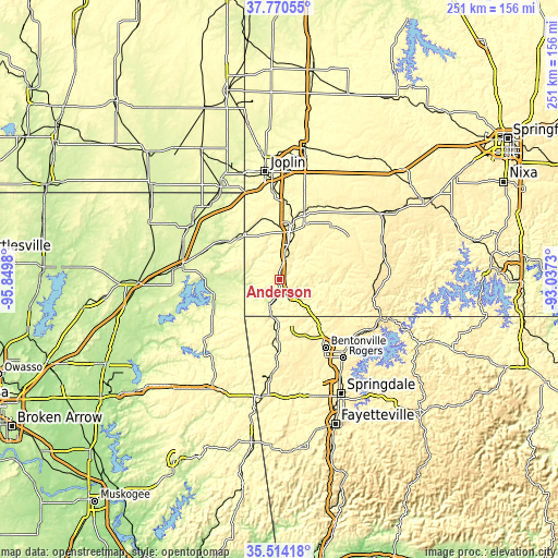
These maps also provides idea of topography and contour of this city, they are displayed at different zoom levels. More info about maps, scale and edge coordinates you can find below images.
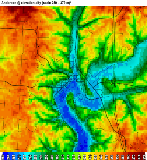
| \ | Map #1 | Topo.Map |
| Scale [m] | 259..379 m | × |
| Scale [ft] | 850..1243 ft | × |
| Average | 322.3 m = 1057 ft | × |
| Width | 7.84 km = 4.9 mi | 250.9 km = 155.9 mi |
| Height | 7.84 km = 4.9 mi | 250.9 km = 155.9 mi |
| ↑Max Latitude | 36.685879° | 37.77055° |
| Latitude at center | 36.65063° | 36.65063° |
| ↓Min Latitude | 36.615365° | 35.51418° |
| ← Min Longitude | -94.487495° | -95.8498° |
| Longitude center | -94.44355° | -94.44355° |
| →Max Longitude | -94.399605° | -93.0373° |
Nearby cities:
Cities around Anderson sort by population:
• Bella Vista elevation 376 m
24.4 km,  140°
140°
• Neosho 319 m
25.2 km,  15°
15°
• Centerton 386 m
35.3 km,  156°
156°
• Grove 240 m
29.7 km,  257°
257°
• Gravette 373 m
25.4 km,  182°
182°
• Seneca 261 m
25.9 km,  324°
324°
• Granby 349 m
34.3 km,  29°
29°
• Noel 258 m
12.3 km,  197°
197°
• Decatur 378 m
35 km, 182°
• Copeland 242 m
34.3 km,  270°
270°
• Goodman 383 m
10.9 km, 21°
• Pineville 277 m
8.2 km, 139°
Multilingual:
 En español:
Anderson elevación 271 m.
 En France:
Anderson élévation 271 m.
 Auf Deutsch:
Anderson höhe über dem Meeresspiegel ist 271 m.

Sources and notes:
- [note 1] Map square and city borders are not equal. Map elevation data is calculated only from area inside that square.
- [src 1] Elevation data from geonames database provided with same terms of usage.
- [src 2] The elevation map of Anderson is generated using elevation data from NASA's 3 arcsec (90m) resolution SRTM data.
- [src 3] Base (background) map © OpenStreetMap contributors tiles are generated by Geofabrik and OpenTopoMap.
Copyright & License:
This Anderson Elevation Map is licensed under CC BY-SA. You may reuse any part from this page, if you give a proper credit by linking to this URL:
 More info on terms of use page.