Travilah elevation
Travilah (Maryland, Montgomery County), United States elevation is 107 meters and Travilah elevation in feet is 351 ft above sea level [src 1]. Travilah is a populated place (feature code) with elevation that is 172 meters (564 ft) smaller than average city elevation in United States.
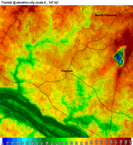
Below is the Elevation map of Travilah, which displays elevation range with different colors. Scale of the first map is from 8 to 147 m (26 to 482 ft) with average elevation of 95.5 meters (=313 ft) [note 1]
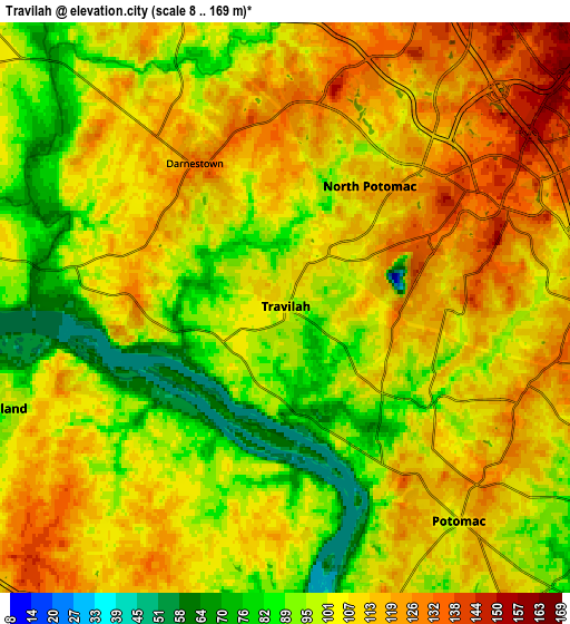
These maps also provides idea of topography and contour of this city, they are displayed at different zoom levels. More info about maps, scale and edge coordinates you can find below images.
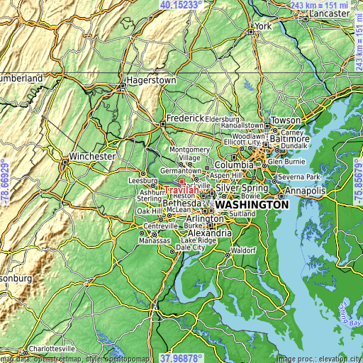
| \ | Map #1 | Map #2 | Topo.Map |
| Scale [m] | 8..147 m | 8..169 m | × |
| Scale [ft] | 26..482 ft | 26..554 ft | × |
| Average | 95.5 m = 313 ft | 104.9 m = 344 ft | × |
| Width | 7.59 km = 4.7 mi | 15.17 km = 9.4 mi | 242.8 km = 150.9 mi |
| Height | 7.59 km = 4.7 mi | 15.17 km = 9.4 mi | 242.8 km = 150.9 mi |
| ↑Max Latitude | 39.10311° | 39.137204° | 40.15233° |
| Latitude at center | 39.069° | 39.069° | 39.069° |
| ↓Min Latitude | 39.034873° | 39.00073° | 37.96878° |
| ← Min Longitude | -77.306985° | -77.350931° | -78.66929° |
| Longitude center | -77.26304° | -77.26304° | -77.26304° |
| →Max Longitude | -77.219095° | -77.175149° | -75.85679° |
Nearby cities:
Cities around Travilah sort by population:
• Germantown elevation 137 m
11.6 km,  356°
356°
• Gaithersburg 153 m
9.8 km,  32°
32°
• Rockville 140 m
9.7 km,  80°
80°
• Potomac 108 m
7.4 km,  140°
140°
• North Bethesda 121 m
12.7 km,  102°
102°
• North Potomac 82 m
1.6 km,  353°
353°
• Great Falls 104 m
8.2 km,  195°
195°
• Dranesville 132 m
10.4 km,  223°
223°
• Sugarland Run 83 m
10.3 km,  250°
250°
• Lowes Island 54 m
7.8 km,  262°
262°
• Darnestown 134 m
4.5 km,  327°
327°
• Derwood 142 m
10.3 km,  58°
58°
Multilingual:
 En español:
Travilah elevación 107 m.
 En France:
Travilah élévation 107 m.
 Auf Deutsch:
Travilah höhe über dem Meeresspiegel ist 107 m.

Sources and notes:
- [note 1] Map square and city borders are not equal. Map elevation data is calculated only from area inside that square.
- [src 1] Elevation data from geonames database provided with same terms of usage.
- [src 2] The elevation map of Travilah is generated using elevation data from NASA's 3 arcsec (90m) resolution SRTM data.
- [src 3] Base (background) map © OpenStreetMap contributors tiles are generated by Geofabrik and OpenTopoMap.
Copyright & License:
This Travilah Elevation Map is licensed under CC BY-SA. You may reuse any part from this page, if you give a proper credit by linking to this URL:
 More info on terms of use page.