Potomac elevation
Potomac (Maryland, Montgomery County), United States elevation is 108 meters and Potomac elevation in feet is 354 ft above sea level [src 1]. Potomac is a populated place (feature code) with elevation that is 171 meters (561 ft) smaller than average city elevation in United States.
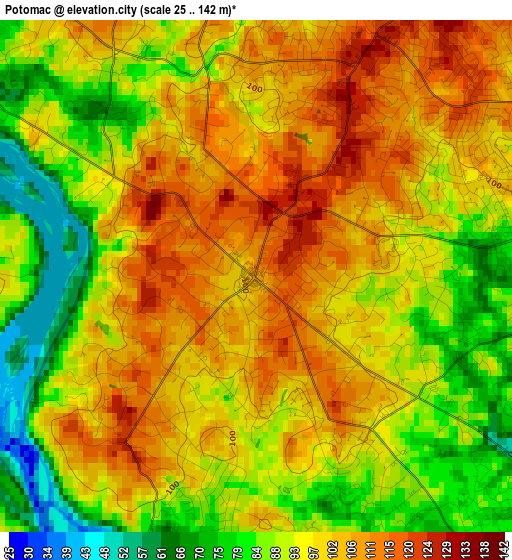
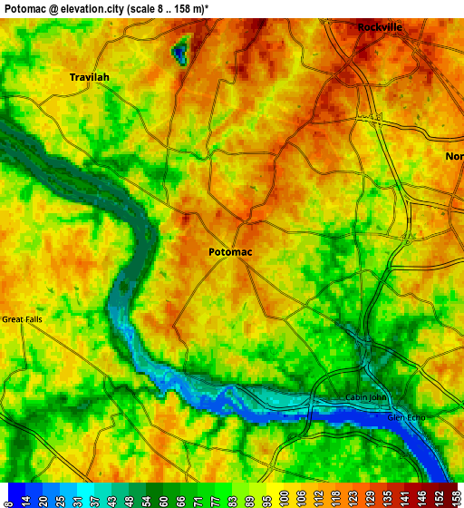
Below is the Elevation map of Potomac, which displays elevation range with different colors. Scale of the first map is from 25 to 142 m (82 to 466 ft) with average elevation of 95.5 meters (=313 ft) [note 1]
These maps also provides idea of topography and contour of this city, they are displayed at different zoom levels. More info about maps, scale and edge coordinates you can find below images.
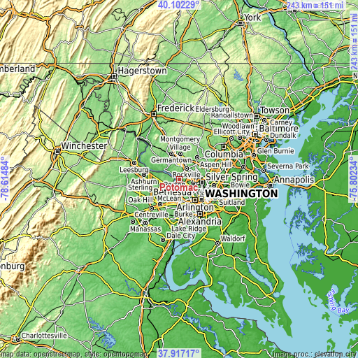
| \ | Map #1 | Map #2 | Topo.Map |
| Scale [m] | 25..142 m | 8..158 m | × |
| Scale [ft] | 82..466 ft | 26..518 ft | × |
| Average | 95.5 m = 313 ft | 92.6 m = 304 ft | × |
| Width | 7.59 km = 4.7 mi | 15.19 km = 9.4 mi | 243 km = 151 mi |
| Height | 7.59 km = 4.7 mi | 15.19 km = 9.4 mi | 243 km = 151 mi |
| ↑Max Latitude | 39.052305° | 39.086423° | 40.10229° |
| Latitude at center | 39.01817° | 39.01817° | 39.01817° |
| ↓Min Latitude | 38.984019° | 38.949851° | 37.91717° |
| ← Min Longitude | -77.252535° | -77.296481° | -78.61484° |
| Longitude center | -77.20859° | -77.20859° | -77.20859° |
| →Max Longitude | -77.164645° | -77.120699° | -75.80234° |
Nearby cities:
Cities around Potomac sort by population:
• Rockville elevation 140 m
8.8 km,  33°
33°
• Bethesda 97 m
10.2 km,  114°
114°
• McLean 91 m
9.7 km,  163°
163°
• North Bethesda 121 m
8.3 km,  69°
69°
• North Potomac 82 m
8.7 km,  325°
325°
• Tysons Corner 144 m
11.2 km,  189°
189°
• Wolf Trap 89 m
11 km,  217°
217°
• Great Falls 104 m
7.2 km,  252°
252°
• Travilah 107 m
7.4 km,  320°
320°
• South Kensington 95 m
11.1 km,  89°
89°
• Cabin John 54 m
6.5 km,  137°
137°
• Garrett Park 96 m
10.2 km,  77°
77°
Multilingual:
 En español:
Potomac elevación 108 m.
 En France:
Potomac élévation 108 m.


Sources and notes:
- [note 1] Map square and city borders are not equal. Map elevation data is calculated only from area inside that square.
- [src 1] Elevation data from geonames database provided with same terms of usage.
- [src 2] The elevation map of Potomac is generated using elevation data from NASA's 3 arcsec (90m) resolution SRTM data.
- [src 3] Base (background) map © OpenStreetMap contributors tiles are generated by Geofabrik and OpenTopoMap.
Copyright & License:
This Potomac Elevation Map is licensed under CC BY-SA. You may reuse any part from this page, if you give a proper credit by linking to this URL:
 More info on terms of use page.