Dranesville elevation
Dranesville (Virginia, Fairfax County), United States elevation is 132 meters and Dranesville elevation in feet is 433 ft above sea level [src 1]. Dranesville is a populated place (feature code) with elevation that is 147 meters (482 ft) smaller than average city elevation in United States.
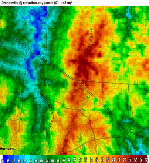
Below is the Elevation map of Dranesville, which displays elevation range with different colors. Scale of the first map is from 67 to 148 m (220 to 486 ft) with average elevation of 107.2 meters (=352 ft) [note 1]
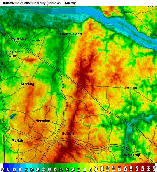
These maps also provides idea of topography and contour of this city, they are displayed at different zoom levels. More info about maps, scale and edge coordinates you can find below images.
| \ | Map #1 | Map #2 | Topo.Map |
| Scale [m] | 67..148 m | 33..148 m | × |
| Scale [ft] | 220..486 ft | 108..486 ft | × |
| Average | 107.2 m = 352 ft | 97 m = 318 ft | × |
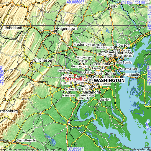
| Width | 7.59 km = 4.7 mi | 15.19 km = 9.4 mi | 243 km = 151 mi |
| Height | 7.59 km = 4.7 mi | 15.19 km = 9.4 mi | 243 km = 151 mi |
| ↑Max Latitude | 39.034813° | 39.06894° | 40.08506° |
| Latitude at center | 39.00067° | 39.00067° | 39.00067° |
| ↓Min Latitude | 38.96651° | 38.932334° | 37.8994° |
| ← Min Longitude | -77.389765° | -77.433711° | -78.75207° |
| Longitude center | -77.34582° | -77.34582° | -77.34582° |
| →Max Longitude | -77.301875° | -77.257929° | -75.93957° |
Nearby cities:
Cities around Dranesville sort by population:
• Reston elevation 102 m
3.6 km,  173°
173°
• Oak Hill 106 m
9.6 km,  210°
210°
• Sterling 90 m
7.2 km,  274°
274°
• Herndon 111 m
4.9 km,  225°
225°
• Wolf Trap 89 m
8.5 km,  142°
142°
• Great Falls 104 m
5 km,  93°
93°
• Sugarland Run 83 m
4.8 km,  328°
328°
• Lowes Island 54 m
6.6 km,  355°
355°
• Countryside 91 m
7.4 km,  307°
307°
• Floris 110 m
9.1 km,  219°
219°
• Dulles Town Center 94 m
7.3 km,  304°
304°
• Oak Grove 117 m
5.3 km,  249°
249°
Multilingual:
 En español:
Dranesville elevación 132 m.
 En France:
Dranesville élévation 132 m.
 Auf Deutsch:
Dranesville höhe über dem Meeresspiegel ist 132 m.

Sources and notes:
- [note 1] Map square and city borders are not equal. Map elevation data is calculated only from area inside that square.
- [src 1] Elevation data from geonames database provided with same terms of usage.
- [src 2] The elevation map of Dranesville is generated using elevation data from NASA's 3 arcsec (90m) resolution SRTM data.
- [src 3] Base (background) map © OpenStreetMap contributors tiles are generated by Geofabrik and OpenTopoMap.
Copyright & License:
This Dranesville Elevation Map is licensed under CC BY-SA. You may reuse any part from this page, if you give a proper credit by linking to this URL:
 More info on terms of use page.