Gaithersburg elevation
Gaithersburg (Maryland, Montgomery County), United States elevation is 153 meters and Gaithersburg elevation in feet is 502 ft above sea level [src 1]. Gaithersburg is a populated place (feature code) with elevation that is 126 meters (413 ft) smaller than average city elevation in United States.
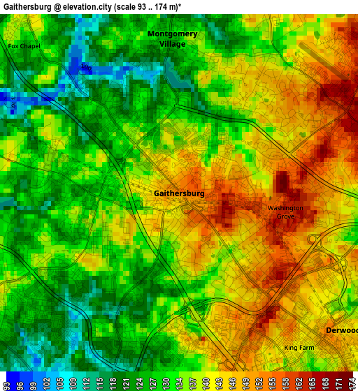
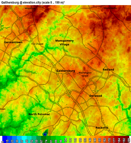
Below is the Elevation map of Gaithersburg, which displays elevation range with different colors. Scale of the first map is from 93 to 174 m (305 to 571 ft) with average elevation of 135.7 meters (=445 ft) [note 1]
These maps also provides idea of topography and contour of this city, they are displayed at different zoom levels. More info about maps, scale and edge coordinates you can find below images.
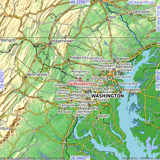
| \ | Map #1 | Map #2 | Topo.Map |
| Scale [m] | 93..174 m | 8..199 m | × |
| Scale [ft] | 305..571 ft | 26..653 ft | × |
| Average | 135.7 m = 445 ft | 133.8 m = 439 ft | × |
| Width | 7.58 km = 4.7 mi | 15.16 km = 9.4 mi | 242.5 km = 150.7 mi |
| Height | 7.58 km = 4.7 mi | 15.16 km = 9.4 mi | 242.5 km = 150.7 mi |
| ↑Max Latitude | 39.177514° | 39.211572° | 40.22561° |
| Latitude at center | 39.14344° | 39.14344° | 39.14344° |
| ↓Min Latitude | 39.109349° | 39.075242° | 38.04437° |
| ← Min Longitude | -77.245315° | -77.289261° | -78.60762° |
| Longitude center | -77.20137° | -77.20137° | -77.20137° |
| →Max Longitude | -77.157425° | -77.113479° | -75.79512° |
Nearby cities:
Cities around Gaithersburg sort by population:
• Germantown elevation 137 m
6.9 km,  298°
298°
• Rockville 140 m
7.8 km,  147°
147°
• Olney 162 m
11.6 km,  84°
84°
• Montgomery Village 118 m
3.7 km,  8°
8°
• North Potomac 82 m
8.7 km,  219°
219°
• Redland 149 m
4.9 km,  87°
87°
• Clarksburg 206 m
12.5 km,  327°
327°
• Travilah 107 m
9.8 km,  212°
212°
• Leisure World 133 m
12.3 km,  111°
111°
• Rossmoor 136 m
12.1 km, 111°
• Darnestown 134 m
8.9 km,  240°
240°
• Derwood 142 m
4.5 km,  129°
129°
Multilingual:
 En español:
Gaithersburg elevación 153 m.
 En France:
Gaithersburg élévation 153 m.
 Auf Deutsch:
Gaithersburg höhe über dem Meeresspiegel ist 153 m.

Sources and notes:
- [note 1] Map square and city borders are not equal. Map elevation data is calculated only from area inside that square.
- [src 1] Elevation data from geonames database provided with same terms of usage.
- [src 2] The elevation map of Gaithersburg is generated using elevation data from NASA's 3 arcsec (90m) resolution SRTM data.
- [src 3] Base (background) map © OpenStreetMap contributors tiles are generated by Geofabrik and OpenTopoMap.
Copyright & License:
This Gaithersburg Elevation Map is licensed under CC BY-SA. You may reuse any part from this page, if you give a proper credit by linking to this URL:
 More info on terms of use page.