Plano elevation
Plano (Kentucky, Warren County), United States elevation is 186 meters and Plano elevation in feet is 610 ft above sea level [src 1]. Plano is a populated place (feature code) with elevation that is 93 meters (305 ft) smaller than average city elevation in United States.
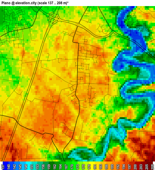
Below is the Elevation map of Plano, which displays elevation range with different colors. Scale of the first map is from 137 to 208 m (449 to 682 ft) with average elevation of 176.5 meters (=579 ft) [note 1]
These maps also provides idea of topography and contour of this city, they are displayed at different zoom levels. More info about maps, scale and edge coordinates you can find below images.
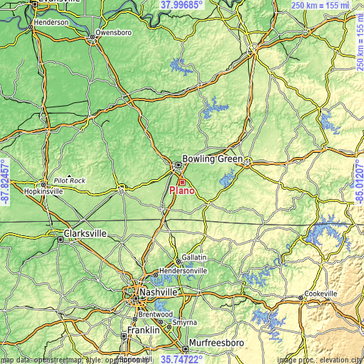
| \ | Map #1 | Topo.Map |
| Scale [m] | 137..208 m | × |
| Scale [ft] | 449..682 ft | × |
| Average | 176.5 m = 579 ft | × |
| Width | 7.82 km = 4.9 mi | 250.1 km = 155.4 mi |
| Height | 7.82 km = 4.9 mi | 250.1 km = 155.4 mi |
| ↑Max Latitude | 36.915463° | 37.99685° |
| Latitude at center | 36.88032° | 36.88032° |
| ↓Min Latitude | 36.84516° | 35.74722° |
| ← Min Longitude | -86.462265° | -87.82457° |
| Longitude center | -86.41832° | -86.41832° |
| →Max Longitude | -86.374375° | -85.01207° |
Nearby cities:
Cities around Plano sort by population:
• Bowling Green elevation 163 m
12.4 km,  349°
349°
• Glasgow 228 m
46.8 km,  74°
74°
• Portland 245 m
34.3 km,  194°
194°
• Franklin 219 m
22.6 km,  218°
218°
• Russellville 185 m
41.9 km,  264°
264°
• Scottsville 231 m
24.7 km,  124°
124°
• Morgantown 173 m
45 km,  328°
328°
• Cave City 195 m
49.9 km,  55°
55°
• Westmoreland 283 m
38.5 km,  156°
156°
• Cross Plains 226 m
44.4 km,  213°
213°
• Auburn 197 m
26 km,  266°
266°
• Brownsville 169 m
37.2 km,  21°
21°
Multilingual:
 En español:
Plano elevación 186 m.
 En France:
Plano élévation 186 m.


Sources and notes:
- [note 1] Map square and city borders are not equal. Map elevation data is calculated only from area inside that square.
- [src 1] Elevation data from geonames database provided with same terms of usage.
- [src 2] The elevation map of Plano is generated using elevation data from NASA's 3 arcsec (90m) resolution SRTM data.
- [src 3] Base (background) map © OpenStreetMap contributors tiles are generated by Geofabrik and OpenTopoMap.
Copyright & License:
This Plano Elevation Map is licensed under CC BY-SA. You may reuse any part from this page, if you give a proper credit by linking to this URL:
 More info on terms of use page.