Howard elevation
Howard (Kansas, Elk County), United States elevation is 320 meters and Howard elevation in feet is 1050 ft above sea level [src 1]. Howard is a seat of a second-order administrative division (feature code) with elevation that is 41 meters (135 ft) bigger than average city elevation in United States.
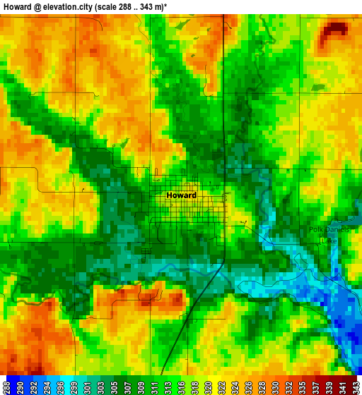
Below is the Elevation map of Howard, which displays elevation range with different colors. Scale of the first map is from 288 to 343 m (945 to 1125 ft) with average elevation of 315.4 meters (=1035 ft) [note 1]
These maps also provides idea of topography and contour of this city, they are displayed at different zoom levels. More info about maps, scale and edge coordinates you can find below images.
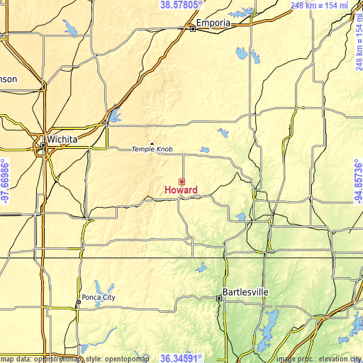
| \ | Map #1 | Topo.Map |
| Scale [m] | 288..343 m | × |
| Scale [ft] | 945..1125 ft | × |
| Average | 315.4 m = 1035 ft | × |
| Width | 7.76 km = 4.8 mi | 248.2 km = 154.2 mi |
| Height | 7.76 km = 4.8 mi | 248.2 km = 154.2 mi |
| ↑Max Latitude | 37.50518° | 38.57805° |
| Latitude at center | 37.47031° | 37.47031° |
| ↓Min Latitude | 37.435424° | 36.34591° |
| ← Min Longitude | -96.307555° | -97.66986° |
| Longitude center | -96.26361° | -96.26361° |
| →Max Longitude | -96.219665° | -94.85736° |
Nearby cities:
Cities around Howard sort by population:
• El Dorado elevation 418 m
65.3 km,  306°
306°
• Augusta 393 m
67.3 km,  290°
290°
• Independence 247 m
56.2 km,  119°
119°
• Clay Center 412 m
45.1 km,  276°
276°
• Eureka 333 m
39.4 km,  356°
356°
• Neodesha 251 m
51.8 km,  96°
96°
• Fredonia 278 m
39.2 km,  79°
79°
• Cherryvale 258 m
66.7 km,  109°
109°
• Caney 239 m
58.7 km,  150°
150°
• Douglass 376 m
66.3 km,  274°
274°
• Yates Center 348 m
65.3 km,  45°
45°
• Sedan 265 m
38.8 km,  169°
169°
Multilingual:
 En español:
Howard elevación 320 m.
 En France:
Howard élévation 320 m.


Sources and notes:
- [note 1] Map square and city borders are not equal. Map elevation data is calculated only from area inside that square.
- [src 1] Elevation data from geonames database provided with same terms of usage.
- [src 2] The elevation map of Howard is generated using elevation data from NASA's 3 arcsec (90m) resolution SRTM data.
- [src 3] Base (background) map © OpenStreetMap contributors tiles are generated by Geofabrik and OpenTopoMap.
Copyright & License:
This Howard Elevation Map is licensed under CC BY-SA. You may reuse any part from this page, if you give a proper credit by linking to this URL:
 More info on terms of use page.