Augusta elevation
Augusta (Kansas, Butler County), United States elevation is 393 meters and Augusta elevation in feet is 1289 ft above sea level [src 1]. Augusta is a populated place (feature code) with elevation that is 114 meters (374 ft) bigger than average city elevation in United States.
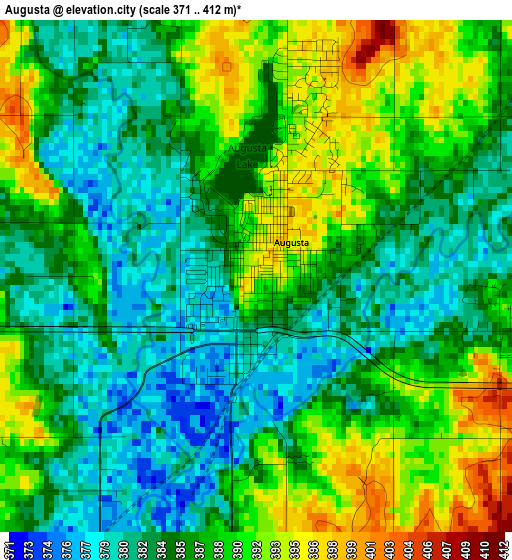
Below is the Elevation map of Augusta, which displays elevation range with different colors. Scale of the first map is from 371 to 412 m (1217 to 1352 ft) with average elevation of 386.4 meters (=1268 ft) [note 1]
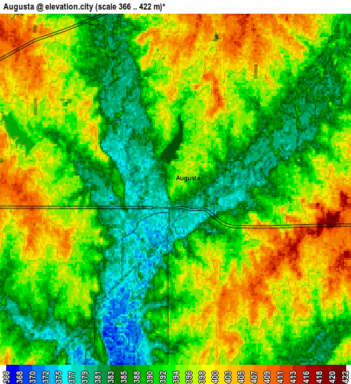
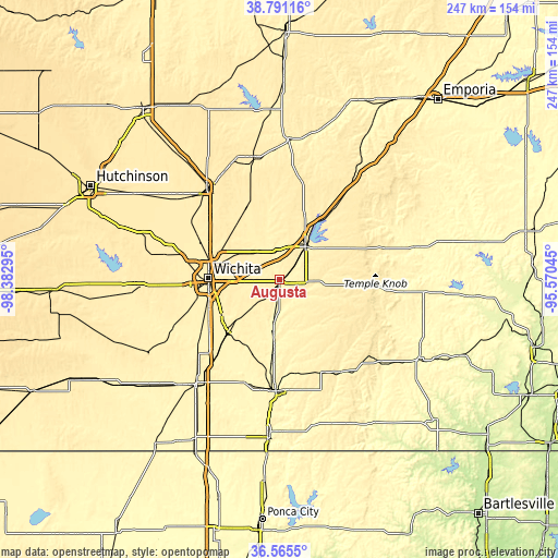
These maps also provides idea of topography and contour of this city, they are displayed at different zoom levels. More info about maps, scale and edge coordinates you can find below images.
| \ | Map #1 | Map #2 | Topo.Map |
| Scale [m] | 371..412 m | 366..422 m | × |
| Scale [ft] | 1217..1352 ft | 1201..1385 ft | × |
| Average | 386.4 m = 1268 ft | 392.7 m = 1288 ft | × |
| Width | 7.73 km = 4.8 mi | 15.47 km = 9.6 mi | 247.5 km = 153.8 mi |
| Height | 7.73 km = 4.8 mi | 15.47 km = 9.6 mi | 247.5 km = 153.8 mi |
| ↑Max Latitude | 37.721449° | 37.756201° | 38.79116° |
| Latitude at center | 37.68668° | 37.68668° | 37.68668° |
| ↓Min Latitude | 37.651895° | 37.617094° | 36.5655° |
| ← Min Longitude | -97.020645° | -97.064591° | -98.38295° |
| Longitude center | -96.9767° | -96.9767° | -96.9767° |
| →Max Longitude | -96.932755° | -96.888809° | -95.57045° |
Nearby cities:
Cities around Augusta sort by population:
• Wichita elevation 402 m
31.8 km,  271°
271°
• Derby 400 m
30.1 km,  238°
238°
• El Dorado 418 m
17.7 km,  34°
34°
• Andover 418 m
14.4 km,  282°
282°
• Park City 421 m
32.6 km,  292°
292°
• Clay Center 412 m
26 km,  135°
135°
• Rose Hill 416 m
20 km,  224°
224°
• Bellaire 431 m
26.9 km, 288°
• Kechi 427 m
29.3 km, 294°
• McConnell AFB 416 m
25.6 km,  255°
255°
• Douglass 376 m
18.9 km,  189°
189°
• Towanda 400 m
12.5 km,  350°
350°
Multilingual:
 En español:
Augusta elevación 393 m.
 En France:
Augusta élévation 393 m.


Sources and notes:
- [note 1] Map square and city borders are not equal. Map elevation data is calculated only from area inside that square.
- [src 1] Elevation data from geonames database provided with same terms of usage.
- [src 2] The elevation map of Augusta is generated using elevation data from NASA's 3 arcsec (90m) resolution SRTM data.
- [src 3] Base (background) map © OpenStreetMap contributors tiles are generated by Geofabrik and OpenTopoMap.
Copyright & License:
This Augusta Elevation Map is licensed under CC BY-SA. You may reuse any part from this page, if you give a proper credit by linking to this URL:
 More info on terms of use page.