Rushville elevation
Rushville (Indiana, Rush County), United States elevation is 294 meters and Rushville elevation in feet is 965 ft above sea level [src 1]. Rushville is a seat of a second-order administrative division (feature code) with elevation that is 15 meters (49 ft) bigger than average city elevation in United States.
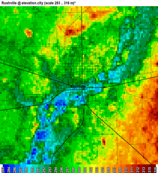
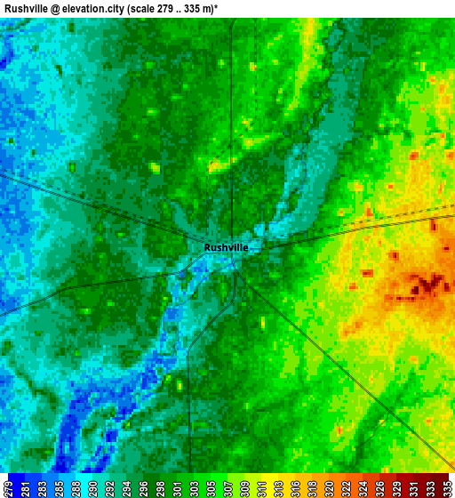
Below is the Elevation map of Rushville, which displays elevation range with different colors. Scale of the first map is from 283 to 316 m (928 to 1037 ft) with average elevation of 297.9 meters (=977 ft) [note 1]
These maps also provides idea of topography and contour of this city, they are displayed at different zoom levels. More info about maps, scale and edge coordinates you can find below images.
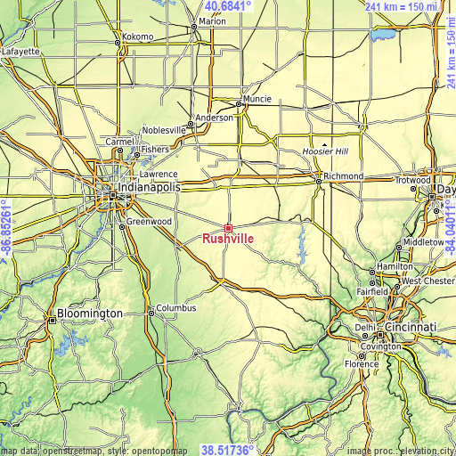
| \ | Map #1 | Map #2 | Topo.Map |
| Scale [m] | 283..316 m | 279..335 m | × |
| Scale [ft] | 928..1037 ft | 915..1099 ft | × |
| Average | 297.9 m = 977 ft | 299.1 m = 981 ft | × |
| Width | 7.53 km = 4.7 mi | 15.06 km = 9.4 mi | 240.9 km = 149.7 mi |
| Height | 7.53 km = 4.7 mi | 15.06 km = 9.4 mi | 240.9 km = 149.7 mi |
| ↑Max Latitude | 39.643058° | 39.676889° | 40.6841° |
| Latitude at center | 39.60921° | 39.60921° | 39.60921° |
| ↓Min Latitude | 39.575346° | 39.541465° | 38.51736° |
| ← Min Longitude | -85.490305° | -85.534251° | -86.85261° |
| Longitude center | -85.44636° | -85.44636° | -85.44636° |
| →Max Longitude | -85.402415° | -85.358469° | -84.04011° |
Nearby cities:
Cities around Rushville sort by population:
• Greenfield elevation 273 m
33.9 km,  305°
305°
• Shelbyville 234 m
30 km,  250°
250°
• New Castle 325 m
36.1 km,  10°
10°
• Connersville 251 m
26.4 km,  82°
82°
• Greensburg 292 m
30.4 km,  186°
186°
• Batesville 298 m
39.4 km,  150°
150°
• New Palestine 258 m
39.9 km,  288°
288°
• Knightstown 286 m
21.8 km,  341°
341°
• Cambridge City 285 m
32.6 km,  46°
46°
• Morristown 255 m
22.7 km, 288°
• Geneva 233 m
33.7 km,  224°
224°
• Saint Paul 261 m
25.5 km, 217°
Multilingual:
 En español:
Rushville elevación 294 m.
 En France:
Rushville élévation 294 m.
 Auf Deutsch:
Rushville höhe über dem Meeresspiegel ist 294 m.

Sources and notes:
- [note 1] Map square and city borders are not equal. Map elevation data is calculated only from area inside that square.
- [src 1] Elevation data from geonames database provided with same terms of usage.
- [src 2] The elevation map of Rushville is generated using elevation data from NASA's 3 arcsec (90m) resolution SRTM data.
- [src 3] Base (background) map © OpenStreetMap contributors tiles are generated by Geofabrik and OpenTopoMap.
Copyright & License:
This Rushville Elevation Map is licensed under CC BY-SA. You may reuse any part from this page, if you give a proper credit by linking to this URL:
 More info on terms of use page.