Shelbyville elevation
Shelbyville (Indiana, Shelby County), United States elevation is 234 meters and Shelbyville elevation in feet is 768 ft above sea level [src 1]. Shelbyville is a seat of a second-order administrative division (feature code) with elevation that is 45 meters (148 ft) smaller than average city elevation in United States.
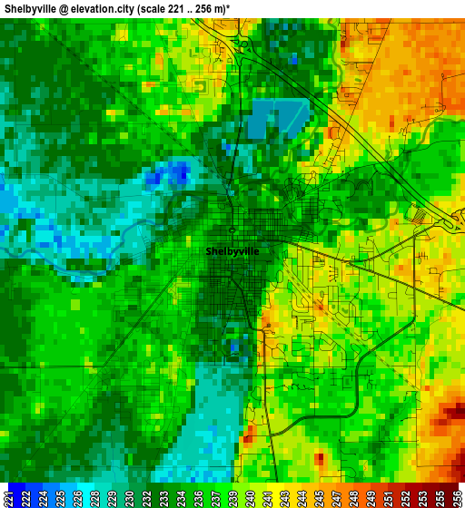
Below is the Elevation map of Shelbyville, which displays elevation range with different colors. Scale of the first map is from 221 to 256 m (725 to 840 ft) with average elevation of 236.1 meters (=775 ft) [note 1]
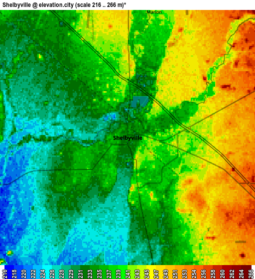
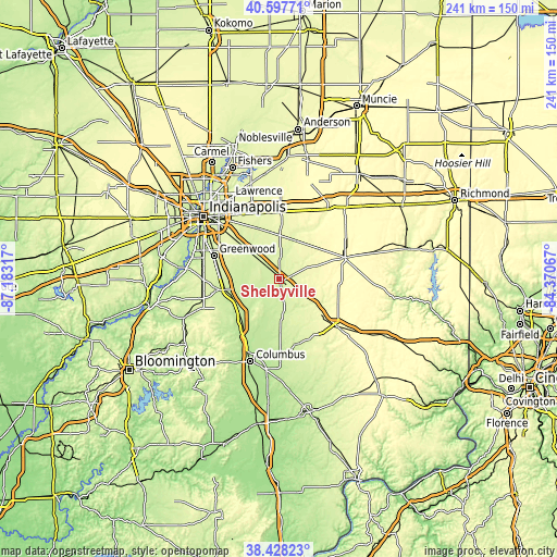
These maps also provides idea of topography and contour of this city, they are displayed at different zoom levels. More info about maps, scale and edge coordinates you can find below images.
| \ | Map #1 | Map #2 | Topo.Map |
| Scale [m] | 221..256 m | 216..266 m | × |
| Scale [ft] | 725..840 ft | 709..873 ft | × |
| Average | 236.1 m = 775 ft | 237.2 m = 778 ft | × |
| Width | 7.54 km = 4.7 mi | 15.08 km = 9.4 mi | 241.2 km = 149.9 mi |
| Height | 7.54 km = 4.7 mi | 15.08 km = 9.4 mi | 241.2 km = 149.9 mi |
| ↑Max Latitude | 39.555331° | 39.589205° | 40.59771° |
| Latitude at center | 39.52144° | 39.52144° | 39.52144° |
| ↓Min Latitude | 39.487533° | 39.453609° | 38.42823° |
| ← Min Longitude | -85.820865° | -85.864811° | -87.18317° |
| Longitude center | -85.77692° | -85.77692° | -85.77692° |
| →Max Longitude | -85.732975° | -85.689029° | -84.37067° |
Nearby cities:
Cities around Shelbyville sort by population:
• Greenwood elevation 246 m
30.1 km,  289°
289°
• Franklin 225 m
24.3 km,  259°
259°
• Greenfield 273 m
29.3 km,  1°
1°
• Rushville 294 m
30 km,  70°
70°
• New Whiteland 245 m
27.6 km,  278°
278°
• Edinburgh 206 m
24.7 km,  221°
221°
• Whiteland 243 m
26.2 km, 276°
• New Palestine 258 m
24.3 km,  336°
336°
• Hope 219 m
24.2 km,  178°
178°
• Morristown 255 m
18.2 km,  21°
21°
• Geneva 233 m
15.2 km,  161°
161°
• Saint Paul 261 m
16.4 km,  129°
129°
Multilingual:
 En español:
Shelbyville elevación 234 m.
 En France:
Shelbyville élévation 234 m.
 Auf Deutsch:
Shelbyville höhe über dem Meeresspiegel ist 234 m.

Sources and notes:
- [note 1] Map square and city borders are not equal. Map elevation data is calculated only from area inside that square.
- [src 1] Elevation data from geonames database provided with same terms of usage.
- [src 2] The elevation map of Shelbyville is generated using elevation data from NASA's 3 arcsec (90m) resolution SRTM data.
- [src 3] Base (background) map © OpenStreetMap contributors tiles are generated by Geofabrik and OpenTopoMap.
Copyright & License:
This Shelbyville Elevation Map is licensed under CC BY-SA. You may reuse any part from this page, if you give a proper credit by linking to this URL:
 More info on terms of use page.