Olney elevation
Olney (Illinois, Richland County), United States elevation is 145 meters and Olney elevation in feet is 476 ft above sea level [src 1]. Olney is a seat of a second-order administrative division (feature code) with elevation that is 134 meters (440 ft) smaller than average city elevation in United States.
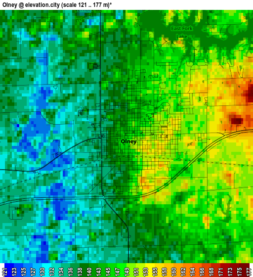
Below is the Elevation map of Olney, which displays elevation range with different colors. Scale of the first map is from 121 to 177 m (397 to 581 ft) with average elevation of 141.6 meters (=465 ft) [note 1]
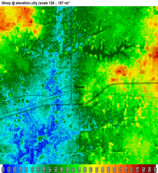
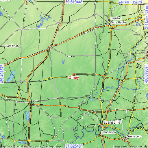
These maps also provides idea of topography and contour of this city, they are displayed at different zoom levels. More info about maps, scale and edge coordinates you can find below images.
| \ | Map #1 | Map #2 | Topo.Map |
| Scale [m] | 121..177 m | 120..187 m | × |
| Scale [ft] | 397..581 ft | 394..614 ft | × |
| Average | 141.6 m = 465 ft | 144.6 m = 474 ft | × |
| Width | 7.62 km = 4.7 mi | 15.25 km = 9.5 mi | 243.9 km = 151.6 mi |
| Height | 7.62 km = 4.7 mi | 15.25 km = 9.5 mi | 243.9 km = 151.6 mi |
| ↑Max Latitude | 38.765153° | 38.79941° | 39.81944° |
| Latitude at center | 38.73088° | 38.73088° | 38.73088° |
| ↓Min Latitude | 38.69659° | 38.662284° | 37.62548° |
| ← Min Longitude | -88.129265° | -88.173211° | -89.49157° |
| Longitude center | -88.08532° | -88.08532° | -88.08532° |
| →Max Longitude | -88.041375° | -87.997429° | -86.67907° |
Nearby cities:
Cities around Olney sort by population:
• Vincennes elevation 131 m
48.7 km,  97°
97°
• Robinson 163 m
42.8 km,  44°
44°
• Mount Carmel 137 m
45.4 km,  141°
141°
• Fairfield 134 m
45.8 km,  211°
211°
• Flora 154 m
35.4 km,  258°
258°
• Lawrenceville 143 m
35 km,  90°
90°
• Sumner 140 m
19.5 km, 94°
• Newton 165 m
29.7 km,  346°
346°
• Albion 160 m
39.4 km,  176°
176°
• Bridgeport 135 m
28.4 km, 95°
• Oblong 156 m
33.8 km,  26°
26°
• Louisville 147 m
36.5 km,  277°
277°
Multilingual:
 En español:
Olney elevación 145 m.
 En France:
Olney élévation 145 m.


Sources and notes:
- [note 1] Map square and city borders are not equal. Map elevation data is calculated only from area inside that square.
- [src 1] Elevation data from geonames database provided with same terms of usage.
- [src 2] The elevation map of Olney is generated using elevation data from NASA's 3 arcsec (90m) resolution SRTM data.
- [src 3] Base (background) map © OpenStreetMap contributors tiles are generated by Geofabrik and OpenTopoMap.
Copyright & License:
This Olney Elevation Map is licensed under CC BY-SA. You may reuse any part from this page, if you give a proper credit by linking to this URL:
 More info on terms of use page.