Charleston elevation
Charleston (Illinois, Coles County), United States elevation is 208 meters and Charleston elevation in feet is 682 ft above sea level [src 1]. Charleston is a seat of a second-order administrative division (feature code) with elevation that is 71 meters (233 ft) smaller than average city elevation in United States.
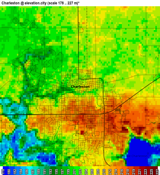
Below is the Elevation map of Charleston, which displays elevation range with different colors. Scale of the first map is from 178 to 227 m (584 to 745 ft) with average elevation of 203.5 meters (=668 ft) [note 1]
These maps also provides idea of topography and contour of this city, they are displayed at different zoom levels. More info about maps, scale and edge coordinates you can find below images.
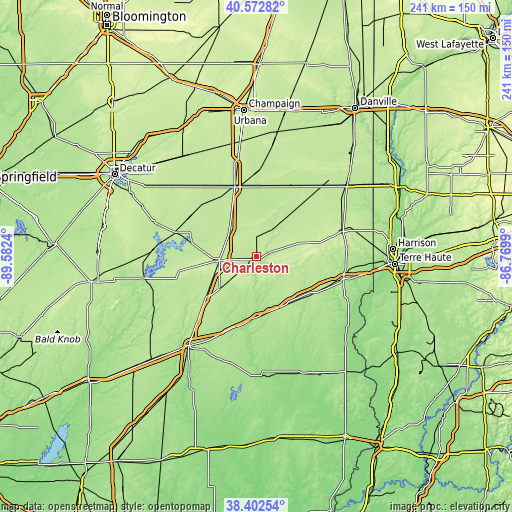
| \ | Map #1 | Map #2 | Topo.Map |
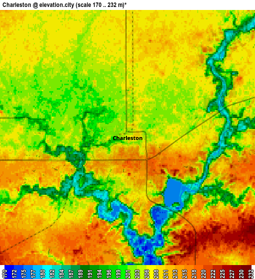
| Scale [m] | 178..227 m | 170..232 m | × |
| Scale [ft] | 584..745 ft | 558..761 ft | × |
| Average | 203.5 m = 668 ft | 205.8 m = 675 ft | × |
| Width | 7.54 km = 4.7 mi | 15.08 km = 9.4 mi | 241.3 km = 149.9 mi |
| Height | 7.54 km = 4.7 mi | 15.08 km = 9.4 mi | 241.3 km = 149.9 mi |
| ↑Max Latitude | 39.530053° | 39.563939° | 40.57282° |
| Latitude at center | 39.49615° | 39.49615° | 39.49615° |
| ↓Min Latitude | 39.462231° | 39.428295° | 38.40254° |
| ← Min Longitude | -88.220095° | -88.264041° | -89.5824° |
| Longitude center | -88.17615° | -88.17615° | -88.17615° |
| →Max Longitude | -88.132205° | -88.088259° | -86.7699° |
Nearby cities:
Cities around Charleston sort by population:
• Mattoon elevation 227 m
16.9 km,  265°
265°
• Sullivan 207 m
38.8 km,  287°
287°
• Tuscola 201 m
34.9 km,  344°
344°
• Arcola 207 m
23.8 km,  331°
331°
• Casey 199 m
27 km,  144°
144°
• Villa Grove 200 m
40.8 km,  1°
1°
• Arthur 202 m
35.1 km,  313°
313°
• Neoga 203 m
30.8 km,  230°
230°
• Greenup 182 m
27.6 km,  177°
177°
• Toledo 183 m
25.4 km,  193°
193°
• Windsor 216 m
36.5 km,  260°
260°
• Martinsville 188 m
30.9 km,  125°
125°
Multilingual:
 En español:
Charleston elevación 208 m.
 En France:
Charleston élévation 208 m.
 Auf Deutsch:
Charleston höhe über dem Meeresspiegel ist 208 m.

Sources and notes:
- [note 1] Map square and city borders are not equal. Map elevation data is calculated only from area inside that square.
- [src 1] Elevation data from geonames database provided with same terms of usage.
- [src 2] The elevation map of Charleston is generated using elevation data from NASA's 3 arcsec (90m) resolution SRTM data.
- [src 3] Base (background) map © OpenStreetMap contributors tiles are generated by Geofabrik and OpenTopoMap.
Copyright & License:
This Charleston Elevation Map is licensed under CC BY-SA. You may reuse any part from this page, if you give a proper credit by linking to this URL:
 More info on terms of use page.