Thomasville elevation
Thomasville (Georgia, Thomas County), United States elevation is 88 meters and Thomasville elevation in feet is 289 ft above sea level [src 1]. Thomasville is a seat of a second-order administrative division (feature code) with elevation that is 191 meters (627 ft) smaller than average city elevation in United States.
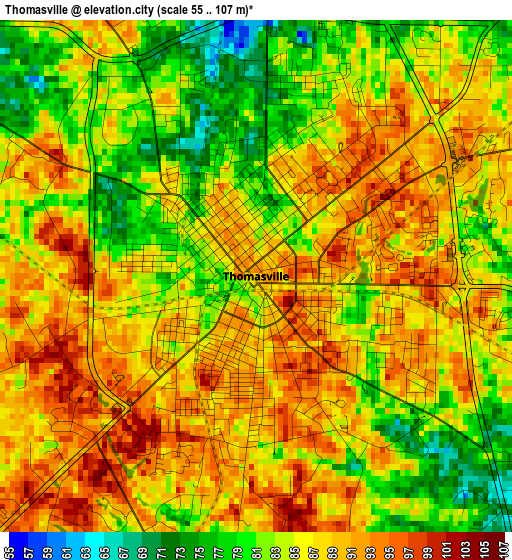
Below is the Elevation map of Thomasville, which displays elevation range with different colors. Scale of the first map is from 55 to 107 m (180 to 351 ft) with average elevation of 85.9 meters (=282 ft) [note 1]
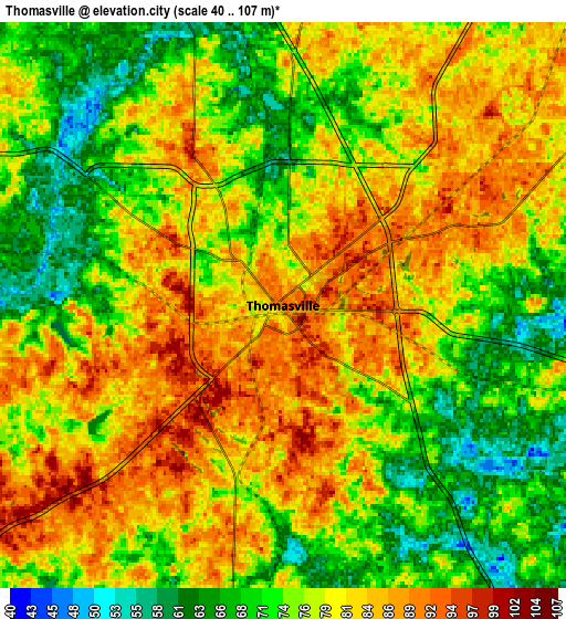
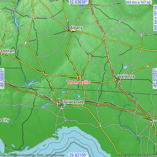
These maps also provides idea of topography and contour of this city, they are displayed at different zoom levels. More info about maps, scale and edge coordinates you can find below images.
| \ | Map #1 | Map #2 | Topo.Map |
| Scale [m] | 55..107 m | 40..107 m | × |
| Scale [ft] | 180..351 ft | 131..351 ft | × |
| Average | 85.9 m = 282 ft | 77.8 m = 255 ft | × |
| Width | 8.39 km = 5.2 mi | 16.78 km = 10.4 mi | 268.5 km = 166.8 mi |
| Height | 8.39 km = 5.2 mi | 16.78 km = 10.4 mi | 268.5 km = 166.8 mi |
| ↑Max Latitude | 30.874305° | 30.912016° | 32.03638° |
| Latitude at center | 30.83658° | 30.83658° | 30.83658° |
| ↓Min Latitude | 30.79884° | 30.761085° | 29.62159° |
| ← Min Longitude | -84.022725° | -84.066671° | -85.38503° |
| Longitude center | -83.97878° | -83.97878° | -83.97878° |
| →Max Longitude | -83.934835° | -83.890889° | -82.57253° |
Nearby cities:
Cities around Thomasville sort by population:
• Tallahassee elevation 71 m
52.9 km,  213°
213°
• Moultrie 102 m
42.2 km,  25°
25°
• Bainbridge 45 m
57.4 km,  277°
277°
• Cairo 82 m
21.8 km, 282°
• Camilla 58 m
49.1 km,  333°
333°
• Quitman 63 m
40.4 km,  98°
98°
• Pelham 119 m
36.4 km, 332°
• Midway 66 m
59.2 km,  230°
230°
• Monticello 76 m
34 km,  162°
162°
• Havana 81 m
47.9 km,  240°
240°
• Boston 68 m
18.7 km,  105°
105°
• Meigs 107 m
28.3 km,  338°
338°
Multilingual:
 En español:
Thomasville elevación 88 m.
 En France:
Thomasville élévation 88 m.
 Auf Deutsch:
Thomasville höhe über dem Meeresspiegel ist 88 m.

Sources and notes:
- [note 1] Map square and city borders are not equal. Map elevation data is calculated only from area inside that square.
- [src 1] Elevation data from geonames database provided with same terms of usage.
- [src 2] The elevation map of Thomasville is generated using elevation data from NASA's 3 arcsec (90m) resolution SRTM data.
- [src 3] Base (background) map © OpenStreetMap contributors tiles are generated by Geofabrik and OpenTopoMap.
Copyright & License:
This Thomasville Elevation Map is licensed under CC BY-SA. You may reuse any part from this page, if you give a proper credit by linking to this URL:
 More info on terms of use page.