Bainbridge elevation
Bainbridge (Georgia, Decatur County), United States elevation is 45 meters and Bainbridge elevation in feet is 148 ft above sea level [src 1]. Bainbridge is a seat of a second-order administrative division (feature code) with elevation that is 234 meters (768 ft) smaller than average city elevation in United States.
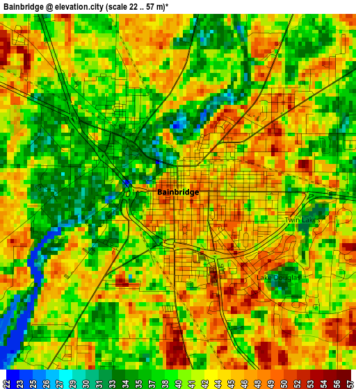
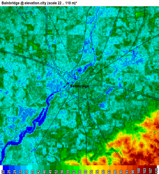
Below is the Elevation map of Bainbridge, which displays elevation range with different colors. Scale of the first map is from 22 to 57 m (72 to 187 ft) with average elevation of 41.6 meters (=136 ft) [note 1]
These maps also provides idea of topography and contour of this city, they are displayed at different zoom levels. More info about maps, scale and edge coordinates you can find below images.
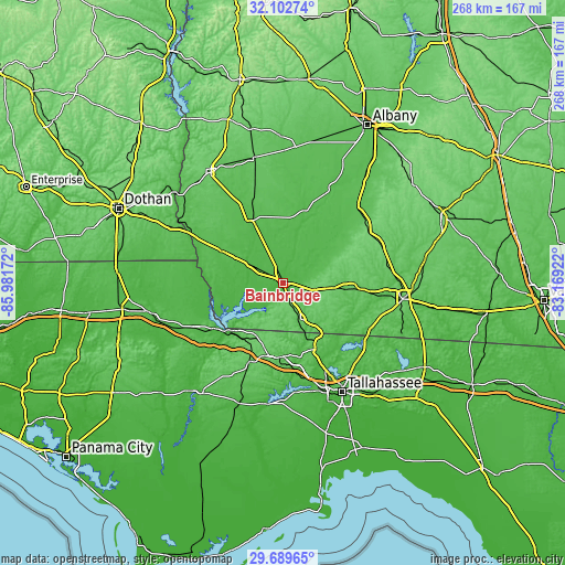
| \ | Map #1 | Map #2 | Topo.Map |
| Scale [m] | 22..57 m | 22..110 m | × |
| Scale [ft] | 72..187 ft | 72..361 ft | × |
| Average | 41.6 m = 136 ft | 46.7 m = 153 ft | × |
| Width | 8.39 km = 5.2 mi | 16.77 km = 10.4 mi | 268.3 km = 166.7 mi |
| Height | 8.39 km = 5.2 mi | 16.77 km = 10.4 mi | 268.3 km = 166.7 mi |
| ↑Max Latitude | 30.941499° | 30.979183° | 32.10274° |
| Latitude at center | 30.9038° | 30.9038° | 30.9038° |
| ↓Min Latitude | 30.866086° | 30.828357° | 29.68965° |
| ← Min Longitude | -84.619415° | -84.663361° | -85.98172° |
| Longitude center | -84.57547° | -84.57547° | -84.57547° |
| →Max Longitude | -84.531525° | -84.487579° | -83.16922° |
Nearby cities:
Cities around Bainbridge sort by population:
• Cairo elevation 82 m
35.7 km,  94°
94°
• Quincy 69 m
35.2 km,  181°
181°
• Camilla 58 m
50.3 km,  43°
43°
• Pelham 119 m
47.3 km,  58°
58°
• Midway 66 m
46.9 km,  165°
165°
• Chattahoochee 80 m
33.9 km,  229°
229°
• Donalsonville 51 m
32.7 km,  297°
297°
• Colquitt 60 m
33.3 km,  333°
333°
• Sneads 46 m
39.9 km,  236°
236°
• Havana 81 m
34.7 km,  153°
153°
• Gretna 98 m
32.9 km,  194°
194°
• Meigs 107 m
50 km,  67°
67°
Multilingual:
 En español:
Bainbridge elevación 45 m.
 En France:
Bainbridge élévation 45 m.
 Auf Deutsch:
Bainbridge höhe über dem Meeresspiegel ist 45 m.

Sources and notes:
- [note 1] Map square and city borders are not equal. Map elevation data is calculated only from area inside that square.
- [src 1] Elevation data from geonames database provided with same terms of usage.
- [src 2] The elevation map of Bainbridge is generated using elevation data from NASA's 3 arcsec (90m) resolution SRTM data.
- [src 3] Base (background) map © OpenStreetMap contributors tiles are generated by Geofabrik and OpenTopoMap.
Copyright & License:
This Bainbridge Elevation Map is licensed under CC BY-SA. You may reuse any part from this page, if you give a proper credit by linking to this URL:
 More info on terms of use page.