Jefferson elevation
Jefferson (Georgia, Putnam County), United States elevation is 171 meters and Jefferson elevation in feet is 561 ft above sea level [src 1]. Jefferson is a populated place (feature code) with elevation that is 108 meters (354 ft) smaller than average city elevation in United States.
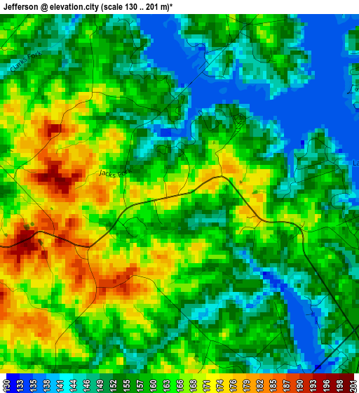
Below is the Elevation map of Jefferson, which displays elevation range with different colors. Scale of the first map is from 130 to 201 m (427 to 659 ft) with average elevation of 158.4 meters (=520 ft) [note 1]
These maps also provides idea of topography and contour of this city, they are displayed at different zoom levels. More info about maps, scale and edge coordinates you can find below images.
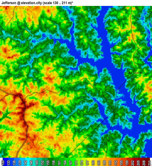
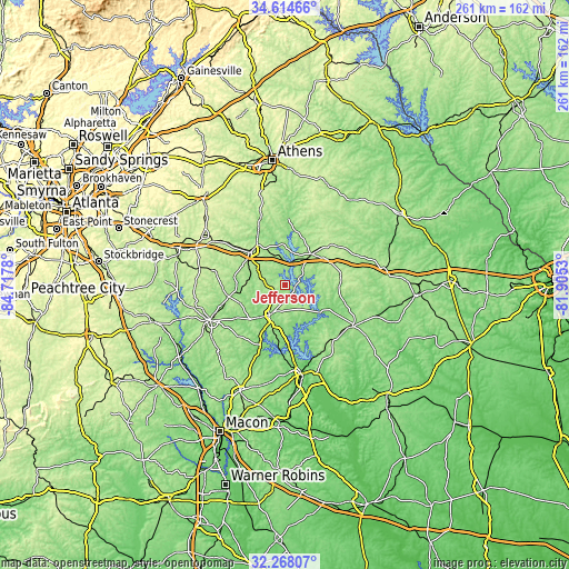
| \ | Map #1 | Map #2 | Topo.Map |
| Scale [m] | 130..201 m | 130..211 m | × |
| Scale [ft] | 427..659 ft | 427..692 ft | × |
| Average | 158.4 m = 520 ft | 161.9 m = 531 ft | × |
| Width | 8.15 km = 5.1 mi | 16.31 km = 10.1 mi | 260.9 km = 162.1 mi |
| Height | 8.15 km = 5.1 mi | 16.31 km = 10.1 mi | 260.9 km = 162.1 mi |
| ↑Max Latitude | 33.485959° | 33.522603° | 34.61466° |
| Latitude at center | 33.4493° | 33.4493° | 33.4493° |
| ↓Min Latitude | 33.412625° | 33.375935° | 32.26807° |
| ← Min Longitude | -83.355495° | -83.399441° | -84.7178° |
| Longitude center | -83.31155° | -83.31155° | -83.31155° |
| →Max Longitude | -83.267605° | -83.223659° | -81.9053° |
Nearby cities:
Cities around Jefferson sort by population:
• Milledgeville elevation 110 m
41.7 km,  169°
169°
• Eatonton 175 m
15.4 km,  207°
207°
• Social Circle 272 m
44.2 km,  301°
301°
• Madison 209 m
21.8 km,  318°
318°
• Hardwick 85 m
43.2 km, 169°
• Greensboro 198 m
18.5 km,  40°
40°
• Watkinsville 224 m
46.9 km,  348°
348°
• Monticello 211 m
38.1 km,  245°
245°
• Union Point 214 m
28.7 km,  49°
49°
• Mount Zion 165 m
29.9 km,  109°
109°
• Sparta 174 m
36.6 km,  121°
121°
• Crawfordville 188 m
40.3 km,  73°
73°
Multilingual:
 En español:
Jefferson elevación 171 m.
 En France:
Jefferson élévation 171 m.
 Auf Deutsch:
Jefferson höhe über dem Meeresspiegel ist 171 m.

Sources and notes:
- [note 1] Map square and city borders are not equal. Map elevation data is calculated only from area inside that square.
- [src 1] Elevation data from geonames database provided with same terms of usage.
- [src 2] The elevation map of Jefferson is generated using elevation data from NASA's 3 arcsec (90m) resolution SRTM data.
- [src 3] Base (background) map © OpenStreetMap contributors tiles are generated by Geofabrik and OpenTopoMap.
Copyright & License:
This Jefferson Elevation Map is licensed under CC BY-SA. You may reuse any part from this page, if you give a proper credit by linking to this URL:
 More info on terms of use page.