Milledgeville elevation
Milledgeville (Georgia, Baldwin County), United States elevation is 110 meters and Milledgeville elevation in feet is 361 ft above sea level [src 1]. Milledgeville is a seat of a second-order administrative division (feature code) with elevation that is 169 meters (554 ft) smaller than average city elevation in United States.
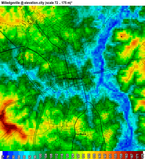
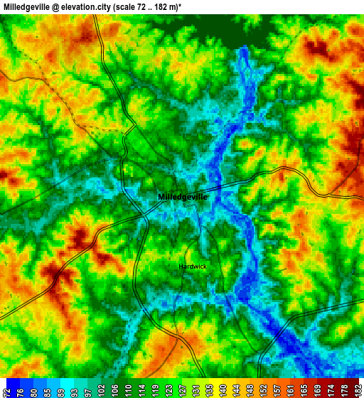
Below is the Elevation map of Milledgeville, which displays elevation range with different colors. Scale of the first map is from 72 to 175 m (236 to 574 ft) with average elevation of 110 meters (=361 ft) [note 1]
These maps also provides idea of topography and contour of this city, they are displayed at different zoom levels. More info about maps, scale and edge coordinates you can find below images.
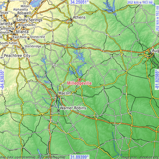
| \ | Map #1 | Map #2 | Topo.Map |
| Scale [m] | 72..175 m | 72..182 m | × |
| Scale [ft] | 236..574 ft | 236..597 ft | × |
| Average | 110 m = 361 ft | 121.5 m = 399 ft | × |
| Width | 8.19 km = 5.1 mi | 16.38 km = 10.2 mi | 262 km = 162.8 mi |
| Height | 8.19 km = 5.1 mi | 16.38 km = 10.2 mi | 262 km = 162.8 mi |
| ↑Max Latitude | 33.116954° | 33.153753° | 34.25051° |
| Latitude at center | 33.08014° | 33.08014° | 33.08014° |
| ↓Min Latitude | 33.04331° | 33.006465° | 31.89399° |
| ← Min Longitude | -83.276045° | -83.319991° | -84.63835° |
| Longitude center | -83.2321° | -83.2321° | -83.2321° |
| →Max Longitude | -83.188155° | -83.144209° | -81.82585° |
Nearby cities:
Cities around Milledgeville sort by population:
• Macon elevation 118 m
45.9 km,  234°
234°
• Eatonton 175 m
31 km,  332°
332°
• Sandersville 141 m
40.8 km,  105°
105°
• Jefferson 171 m
41.7 km,  349°
349°
• Hardwick 85 m
1.6 km,  148°
148°
• Gray 188 m
29.2 km,  254°
254°
• Gordon 109 m
23.9 km,  203°
203°
• Tennille 146 m
42.4 km, 112°
• Mount Zion 165 m
37.6 km,  33°
33°
• Sparta 174 m
32.2 km,  47°
47°
• Jeffersonville 163 m
44.9 km,  193°
193°
• Irwinton 135 m
30.4 km,  169°
169°
Multilingual:
 En español:
Milledgeville elevación 110 m.
 En France:
Milledgeville élévation 110 m.
 Auf Deutsch:
Milledgeville höhe über dem Meeresspiegel ist 110 m.

Sources and notes:
- [note 1] Map square and city borders are not equal. Map elevation data is calculated only from area inside that square.
- [src 1] Elevation data from geonames database provided with same terms of usage.
- [src 2] The elevation map of Milledgeville is generated using elevation data from NASA's 3 arcsec (90m) resolution SRTM data.
- [src 3] Base (background) map © OpenStreetMap contributors tiles are generated by Geofabrik and OpenTopoMap.
Copyright & License:
This Milledgeville Elevation Map is licensed under CC BY-SA. You may reuse any part from this page, if you give a proper credit by linking to this URL:
 More info on terms of use page.