Gainesville elevation
Gainesville (Georgia, Hall County), United States elevation is 380 meters and Gainesville elevation in feet is 1247 ft above sea level [src 1]. Gainesville is a seat of a second-order administrative division (feature code) with elevation that is 101 meters (331 ft) bigger than average city elevation in United States.
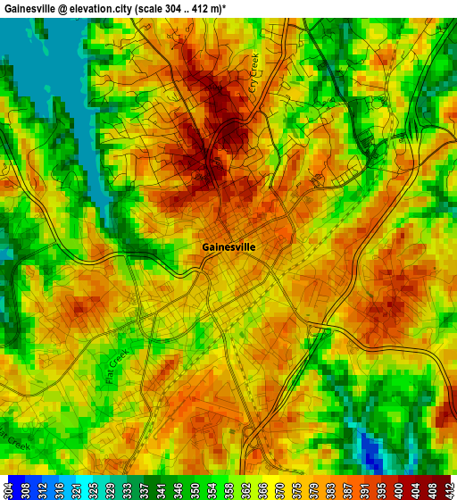
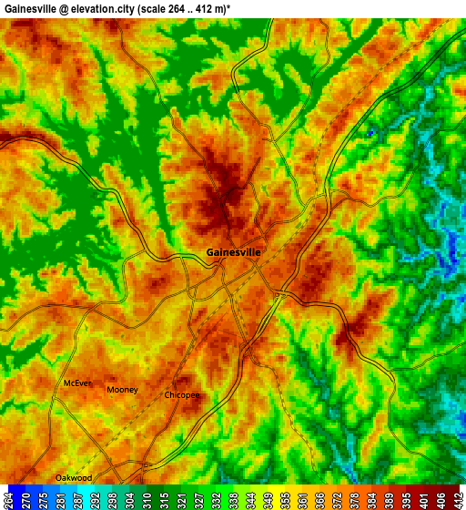
Below is the Elevation map of Gainesville, which displays elevation range with different colors. Scale of the first map is from 304 to 412 m (997 to 1352 ft) with average elevation of 367.4 meters (=1205 ft) [note 1]
These maps also provides idea of topography and contour of this city, they are displayed at different zoom levels. More info about maps, scale and edge coordinates you can find below images.
| \ | Map #1 | Map #2 | Topo.Map |
| Scale [m] | 304..412 m | 264..412 m | × |
| Scale [ft] | 997..1352 ft | 866..1352 ft | × |
| Average | 367.4 m = 1205 ft | 350.6 m = 1150 ft | × |
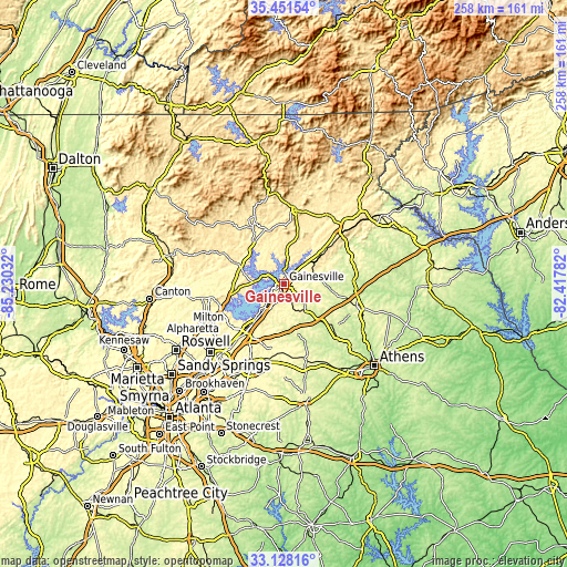
| Width | 8.07 km = 5 mi | 16.15 km = 10 mi | 258.3 km = 160.5 mi |
| Height | 8.07 km = 5 mi | 16.15 km = 10 mi | 258.3 km = 160.5 mi |
| ↑Max Latitude | 34.334176° | 34.370457° | 35.45154° |
| Latitude at center | 34.29788° | 34.29788° | 34.29788° |
| ↓Min Latitude | 34.261568° | 34.225241° | 33.12816° |
| ← Min Longitude | -83.868015° | -83.911961° | -85.23032° |
| Longitude center | -83.82407° | -83.82407° | -83.82407° |
| →Max Longitude | -83.780125° | -83.736179° | -82.41782° |
Nearby cities:
Cities around Gainesville sort by population:
• Sugar Hill elevation 352 m
28.7 km,  222°
222°
• Buford 360 m
25.8 km, 220°
• Braselton 282 m
21.7 km,  164°
164°
• Flowery Branch 341 m
15.6 km, 216°
• Dahlonega 444 m
30 km,  330°
330°
• Oakwood 351 m
9.6 km, 215°
• Lula 400 m
17.6 km,  55°
55°
• Raoul 430 m
27 km,  51°
51°
• Maysville 274 m
24.6 km,  101°
101°
• Hoschton 282 m
23.1 km,  165°
165°
• Alto 427 m
29.7 km, 50°
• Homer 251 m
30.1 km,  82°
82°
Multilingual:
 En español:
Gainesville elevación 380 m.
 En France:
Gainesville élévation 380 m.
 Auf Deutsch:
Gainesville höhe über dem Meeresspiegel ist 380 m.

Sources and notes:
- [note 1] Map square and city borders are not equal. Map elevation data is calculated only from area inside that square.
- [src 1] Elevation data from geonames database provided with same terms of usage.
- [src 2] The elevation map of Gainesville is generated using elevation data from NASA's 3 arcsec (90m) resolution SRTM data.
- [src 3] Base (background) map © OpenStreetMap contributors tiles are generated by Geofabrik and OpenTopoMap.
Copyright & License:
This Gainesville Elevation Map is licensed under CC BY-SA. You may reuse any part from this page, if you give a proper credit by linking to this URL:
 More info on terms of use page.