Sulligent elevation
Sulligent (Alabama, Lamar County), United States elevation is 100 meters and Sulligent elevation in feet is 328 ft above sea level [src 1]. Sulligent is a populated place (feature code) with elevation that is 179 meters (587 ft) smaller than average city elevation in United States.
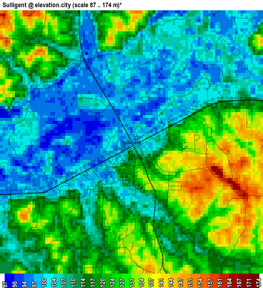
Below is the Elevation map of Sulligent, which displays elevation range with different colors. Scale of the first map is from 87 to 174 m (285 to 571 ft) with average elevation of 114.8 meters (=377 ft) [note 1]
These maps also provides idea of topography and contour of this city, they are displayed at different zoom levels. More info about maps, scale and edge coordinates you can find below images.
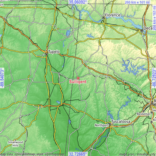
| \ | Map #1 | Topo.Map |
| Scale [m] | 87..174 m | × |
| Scale [ft] | 285..571 ft | × |
| Average | 114.8 m = 377 ft | × |
| Width | 8.11 km = 5 mi | 259.5 km = 161.2 mi |
| Height | 8.11 km = 5 mi | 259.5 km = 161.2 mi |
| ↑Max Latitude | 33.938237° | 35.06092° |
| Latitude at center | 33.90177° | 33.90177° |
| ↓Min Latitude | 33.865288° | 32.72665° |
| ← Min Longitude | -88.178425° | -89.54073° |
| Longitude center | -88.13448° | -88.13448° |
| →Max Longitude | -88.090535° | -86.72823° |
Nearby cities:
Cities around Sulligent sort by population:
• Amory elevation 76 m
33.9 km,  285°
285°
• Hamilton 152 m
29.9 km,  26°
26°
• Aberdeen 71 m
38.7 km,  257°
257°
• Winfield 145 m
29.4 km,  84°
84°
• Fayette 111 m
37 km,  130°
130°
• Fulton 106 m
48.5 km,  328°
328°
• Guin 137 m
21.5 km,  70°
70°
• Nettleton 80 m
49.6 km, 294°
• Vernon 91 m
16.3 km,  171°
171°
• Hackleburg 286 m
50.4 km, 33°
• Columbus Air Force Base 63 m
41.9 km,  224°
224°
• Caledonia 102 m
30 km, 215°
Multilingual:
 En español:
Sulligent elevación 100 m.
 En France:
Sulligent élévation 100 m.
 Auf Deutsch:
Sulligent höhe über dem Meeresspiegel ist 100 m.

Sources and notes:
- [note 1] Map square and city borders are not equal. Map elevation data is calculated only from area inside that square.
- [src 1] Elevation data from geonames database provided with same terms of usage.
- [src 2] The elevation map of Sulligent is generated using elevation data from NASA's 3 arcsec (90m) resolution SRTM data.
- [src 3] Base (background) map © OpenStreetMap contributors tiles are generated by Geofabrik and OpenTopoMap.
Copyright & License:
This Sulligent Elevation Map is licensed under CC BY-SA. You may reuse any part from this page, if you give a proper credit by linking to this URL:
 More info on terms of use page.