Falkville elevation
Falkville (Alabama, Morgan County), United States elevation is 183 meters and Falkville elevation in feet is 600 ft above sea level [src 1]. Falkville is a populated place (feature code) with elevation that is 96 meters (315 ft) smaller than average city elevation in United States.
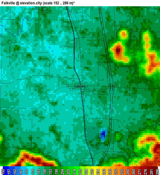
Below is the Elevation map of Falkville, which displays elevation range with different colors. Scale of the first map is from 152 to 286 m (499 to 938 ft) with average elevation of 191.3 meters (=628 ft) [note 1]
These maps also provides idea of topography and contour of this city, they are displayed at different zoom levels. More info about maps, scale and edge coordinates you can find below images.
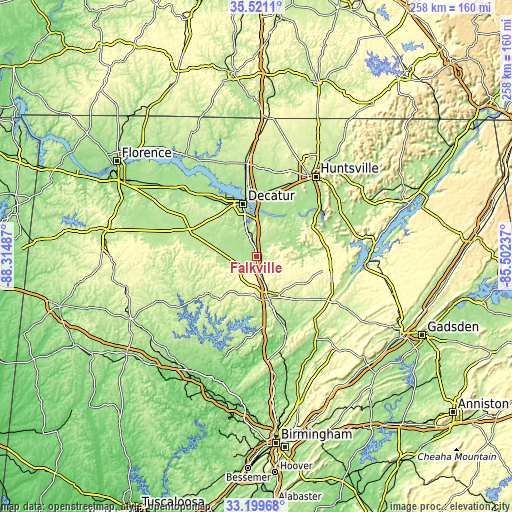
| \ | Map #1 | Topo.Map |
| Scale [m] | 152..286 m | × |
| Scale [ft] | 499..938 ft | × |
| Average | 191.3 m = 628 ft | × |
| Width | 8.07 km = 5 mi | 258.1 km = 160.4 mi |
| Height | 8.07 km = 5 mi | 258.1 km = 160.4 mi |
| ↑Max Latitude | 34.404696° | 35.5211° |
| Latitude at center | 34.36843° | 34.36843° |
| ↓Min Latitude | 34.332149° | 33.19968° |
| ← Min Longitude | -86.952565° | -88.31487° |
| Longitude center | -86.90862° | -86.90862° |
| →Max Longitude | -86.864675° | -85.50237° |
Nearby cities:
Cities around Falkville sort by population:
• Decatur elevation 175 m
27.3 km,  345°
345°
• Madison 217 m
39.6 km,  21°
21°
• Cullman 244 m
22.3 km,  164°
164°
• Hartselle 203 m
8.7 km,  343°
343°
• Arab 336 m
38.3 km,  98°
98°
• Danville 188 m
17.2 km,  287°
287°
• Moulton 196 m
37.4 km, 289°
• Hanceville 168 m
36.6 km, 159°
• Priceville 188 m
17.5 km,  4°
4°
• Good Hope 215 m
28.4 km,  171°
171°
• Trinity 197 m
31.2 km,  328°
328°
• Flint City 188 m
18.1 km, 341°
Multilingual:
 En español:
Falkville elevación 183 m.
 En France:
Falkville élévation 183 m.
 Auf Deutsch:
Falkville höhe über dem Meeresspiegel ist 183 m.

Sources and notes:
- [note 1] Map square and city borders are not equal. Map elevation data is calculated only from area inside that square.
- [src 1] Elevation data from geonames database provided with same terms of usage.
- [src 2] The elevation map of Falkville is generated using elevation data from NASA's 3 arcsec (90m) resolution SRTM data.
- [src 3] Base (background) map © OpenStreetMap contributors tiles are generated by Geofabrik and OpenTopoMap.
Copyright & License:
This Falkville Elevation Map is licensed under CC BY-SA. You may reuse any part from this page, if you give a proper credit by linking to this URL:
 More info on terms of use page.