Moulton elevation
Moulton (Alabama, Lawrence County), United States elevation is 196 meters and Moulton elevation in feet is 643 ft above sea level [src 1]. Moulton is a seat of a second-order administrative division (feature code) with elevation that is 83 meters (272 ft) smaller than average city elevation in United States.
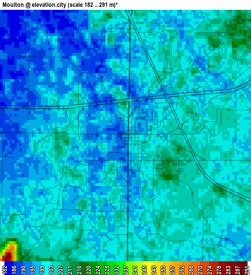
Below is the Elevation map of Moulton, which displays elevation range with different colors. Scale of the first map is from 182 to 291 m (597 to 955 ft) with average elevation of 199.6 meters (=655 ft) [note 1]
These maps also provides idea of topography and contour of this city, they are displayed at different zoom levels. More info about maps, scale and edge coordinates you can find below images.
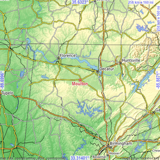
| \ | Map #1 | Topo.Map |
| Scale [m] | 182..291 m | × |
| Scale [ft] | 597..955 ft | × |
| Average | 199.6 m = 655 ft | × |
| Width | 8.06 km = 5 mi | 257.8 km = 160.2 mi |
| Height | 8.06 km = 5 mi | 257.8 km = 160.2 mi |
| ↑Max Latitude | 34.517427° | 35.6323° |
| Latitude at center | 34.48121° | 34.48121° |
| ↓Min Latitude | 34.444977° | 33.31401° |
| ← Min Longitude | -87.337295° | -88.6996° |
| Longitude center | -87.29335° | -87.29335° |
| →Max Longitude | -87.249405° | -85.8871° |
Nearby cities:
Cities around Moulton sort by population:
• Decatur elevation 175 m
31.6 km,  63°
63°
• Hartselle 203 m
33.1 km,  97°
97°
• Russellville 234 m
40 km,  274°
274°
• Danville 188 m
20.3 km,  111°
111°
• Priceville 188 m
36.9 km,  82°
82°
• Trinity 197 m
23.4 km,  53°
53°
• Falkville 183 m
37.4 km, 109°
• Phil Campbell 313 m
40.6 km,  249°
249°
• Rogersville 194 m
38.3 km,  359°
359°
• Town Creek 174 m
24.5 km,  335°
335°
• Double Springs 253 m
38.6 km,  195°
195°
• Flint City 188 m
30 km, 81°
Multilingual:
 En español:
Moulton elevación 196 m.
 En France:
Moulton élévation 196 m.


Sources and notes:
- [note 1] Map square and city borders are not equal. Map elevation data is calculated only from area inside that square.
- [src 1] Elevation data from geonames database provided with same terms of usage.
- [src 2] The elevation map of Moulton is generated using elevation data from NASA's 3 arcsec (90m) resolution SRTM data.
- [src 3] Base (background) map © OpenStreetMap contributors tiles are generated by Geofabrik and OpenTopoMap.
Copyright & License:
This Moulton Elevation Map is licensed under CC BY-SA. You may reuse any part from this page, if you give a proper credit by linking to this URL:
 More info on terms of use page.